

The Sea to Sky Highway (AKA Hwy 99) has to be one of the most beautiful road trips in North America. After living in Vancouver for well over a year and driving this route many times, we can still say it’s one of our favourite drives. The views from the road are incredible and there are many places where you can stop for views, food, hiking and other activities. If you’re in Vancouver for a few days, we would recommend adding the Sea To Sky to your itinerary as it’s a fantastic way to experience some of Canada’s natural beauty.
How we created this Sea to Sky Highway guide
With so many incredible stops along the Sea to Sky Highway, we couldn’t possibly include them all. Instead, we’ve handpicked our personal favourites that we think might be worth your while. If you’re short on time and need to be selective about where to stop, pick one or two must-see spots and consider skipping the rest. This way you’ll make the most of your experience instead of rushing from one stop to the next.
How long is the Sea to Sky Highway?
The Sea to Sky highway is a breathtaking 134-kilometre (83 miles) section of Highway 99. Starting in the seaside village of Horseshoe Bay, this scenic route takes you through Squamish and Whistler all the way to Pemberton. For this guide, we’ve also included Joffre Lakes, a backcountry park another 30 km past Pemberton, making the total journey around 164 km. Technically, the last section is known as Duffy Lake Road, not the Sea to Sky Highway. However, Joffre Lakes is one of the most beautiful places in British Columbia, so it deserves to be on this list.
Interesting to know: You’ll start the drive at about sea level in Vancouver. Although you won’t really notice it while driving, by the time you reach Whistler, you’ll be at an elevation of 670 metres. If you continue to Pemberton, the elevation will drop back down to 210 metres.
What is the most scenic part of the Sea to Sky Highway?
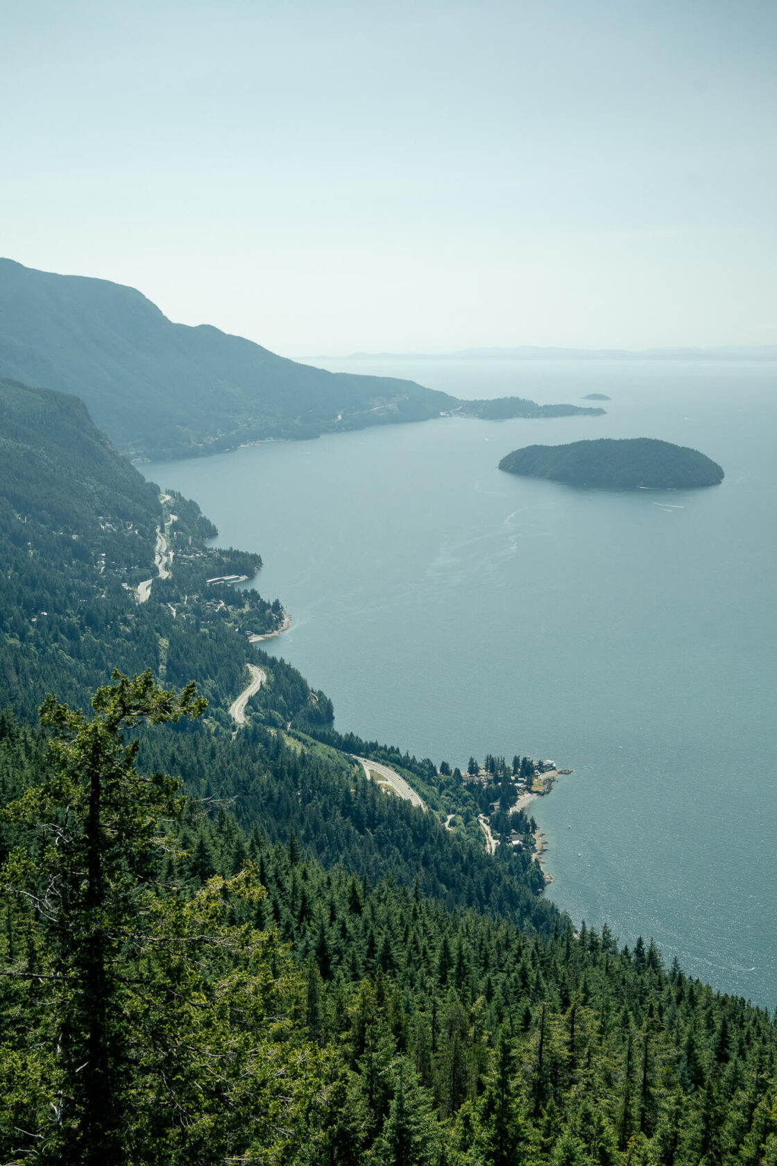
The most picturesque part of the drive is between Vancouver and Squamish. This section takes you along the steep slopes of the Howe Sound Fjord, with stunning views of the deep blue ocean, forested islands, and the snow-capped peaks of the Coast Mountains. As you approach Squamish, the views gradually transition into mountain landscapes, until you reach a forested valley that leads to Whistler.
How many days will you need?
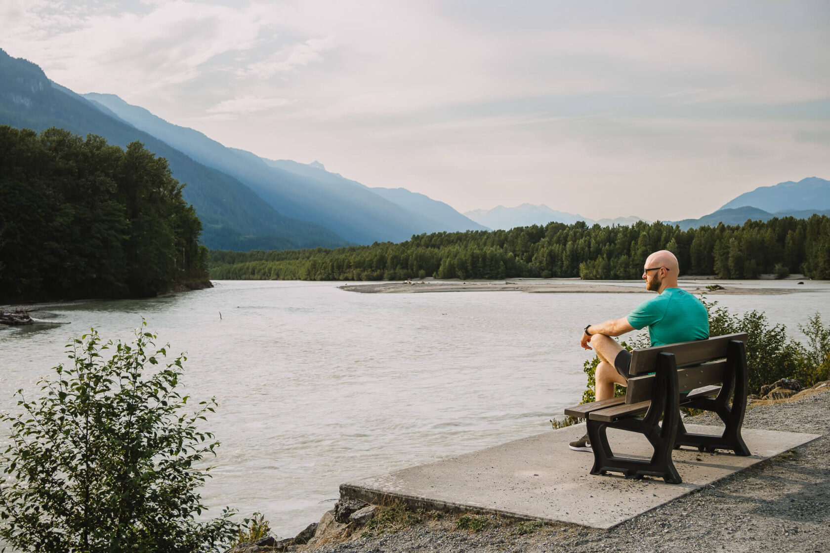
Even if you like staying close to the car, we recommend allocating at least one full day to this trip. You could easily drive the entire Sea to Sky corridor in two hours, but the viewpoints, gondola rides and short hikes will have the time slip away. If you’re on a road trip through Canada, or you’re planning to do some outdoor activities like hiking, one day simply won’t be enough. Consider staying in Squamish, Whistler or Pemberton to allow yourself plenty of time to explore this beautiful part of British Columbia.
To help you plan, we’ve included sample itineraries at the end of this guide. Each itinerary features a selection of the best stops we covered here, so you can make the most of your trip.
When is the best time to do the Sea to Sky road trip?
Weather
Choose a day with good weather so you can fully appreciate the natural beauty along the route. The experience isn’t the same when it’s overcast or raining, as the mountains are often hidden in the clouds.
Best Seasons to Visit
As far as seasons go, the Sea to Sky is open year-round. But unless you’re coming for winter sports, we recommend visiting between May and September. During these months the weather is warm, the skies are blue, and everything looks a lot more beautiful bathed in the sun.
Spring
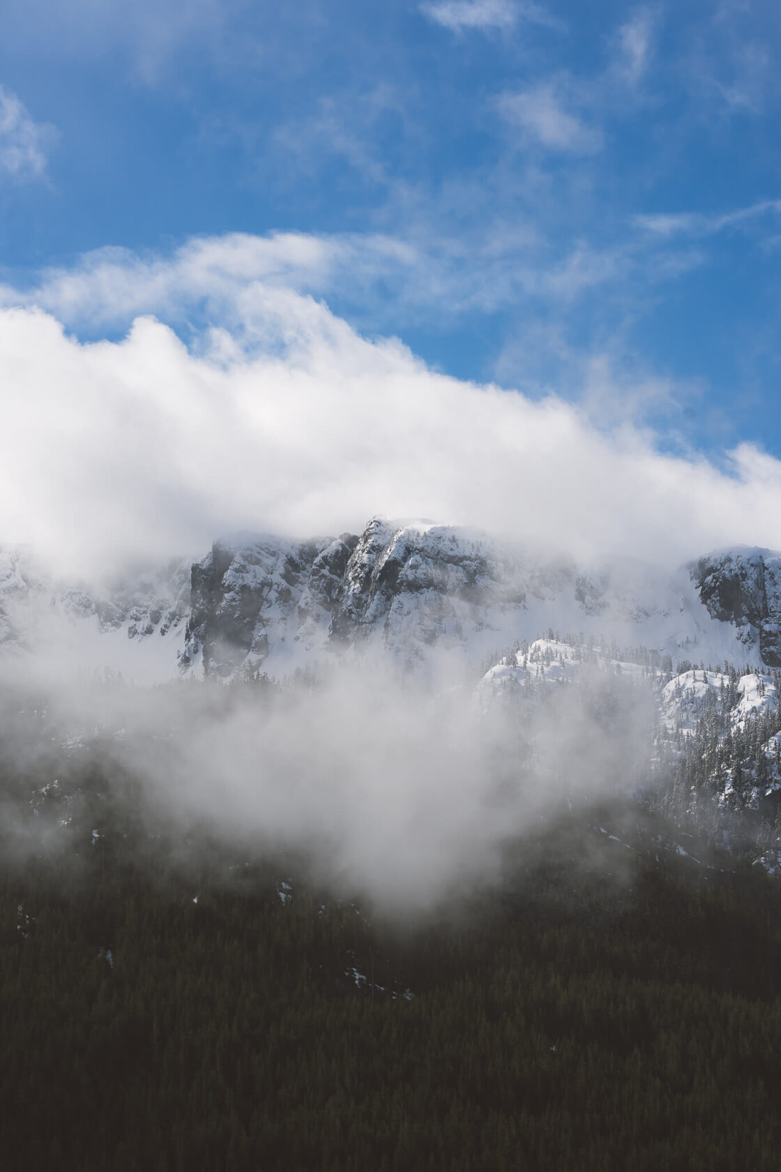
Late spring makes for perfect hiking weather but most peaks are still covered in snow. You might be fine hiking Squamish peaks like Stawamus Chief, but expect snowy conditions in Garibaldi Provincial Park, Whistler and Pemberton. Melting ice and snow make waterfalls particularly powerful during this time of year. Late spring is also a great time to spot bears, often seen from the Whistler gondola. However, there are no guarantees you’ll see one, so don’t plan your trip around it.
Summer
Summer is a beautiful time of the year to visit, but it’s also the busiest. As most outdoor activities are best done in summer months, hiking trails and parks get crowded so expect having to make advance reservations. If there’s a place you want to see before all tourists arrive, our best advice is to get there early. As summer months sometimes see wild forest fires or smoke, be prepared that you may have to be flexible with your plans.
Fall
Early fall is popular for changing colours and cooler temperatures, but you can expect a lot more rain, even in September and October. The upside is fewer tourists, so most trails and attractions are much quieter.
Winter
Winter brings rain and snow and you may no longer be able to access some of the trails. Also, some must-see stops are closed from November to May. For example, Brandywine Falls is only open from May 1 to October 31. However, if you’re visiting for winter sports, you’ll find plenty to enjoy despite the closures.
Tips for Driving the Sea to Sky Highway
Before we jump in to it, here are some practical things to know about driving the Sea To Sky highway:
- The Sea to Sky Highway can get busy, especially on weekends. As there are no alternative routes, traffic can be bad at times, and if there’s an accident, you can get stuck for a few hours. While such delays are not that frequent, we’ve learned the hard way to always keep snacks and water in the car just in case. You can check this Facebook group for updates on conditions. People only post when something happens, so if you don’t see any recent posts, you’re good to go.
- Driver distraction can be a real problem on the Sea to Sky Highway. The first time we drove to Squamish it was hard to keep our eyes on the road because the scenery is so gorgeous. If this is your first time driving this route, consider bringing a second driver so you can swap seats on the way back and everyone can enjoy the view.
- Some places along the route may be open or closed depending on the season, so it’s always best to check ahead.
- From October 1 to March 31, you’ll need winter tires or chains, regardless if it’s snowing or not.
- Make a note of the places where you want to stop and which side of the highway they’re on. Often, it’s not possible to cross, and some places like Tantalus Lookout are easier to visit on the drive back to Vancouver.
- Keep focused on your stops as once you drive past them, it’s not easy to go back as there aren’t many places where you can cross the highway.
15 Best Stops Along the Sea to Sky Highway
Now it’s time for the good stuff – where to stop and what to see along the Sea to Sky highway! We recommend starting your trip as early as possible to make the most of your time.
Sea to Sky Highway map
Below you’ll find a map for your Sea To Sky road trip which features pins for each stop. You can use it to gauge driving distances between them.
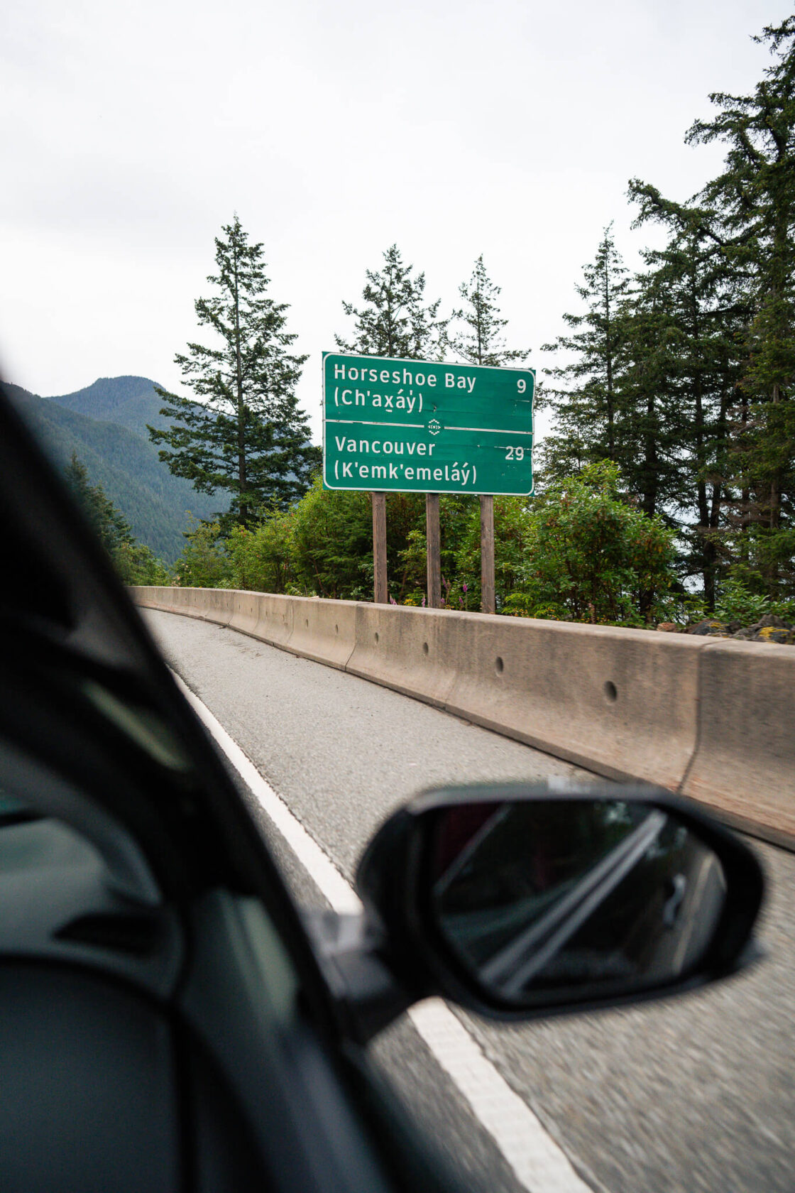
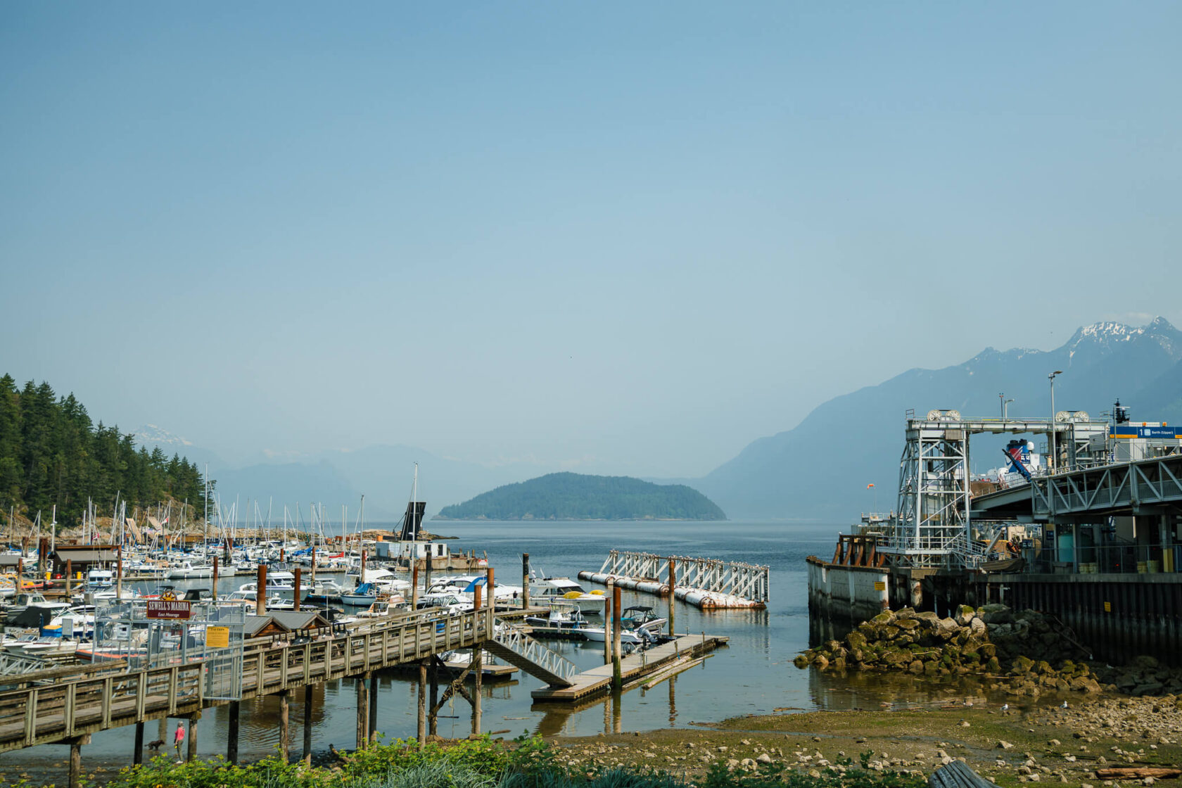
1. Horseshoe Bay
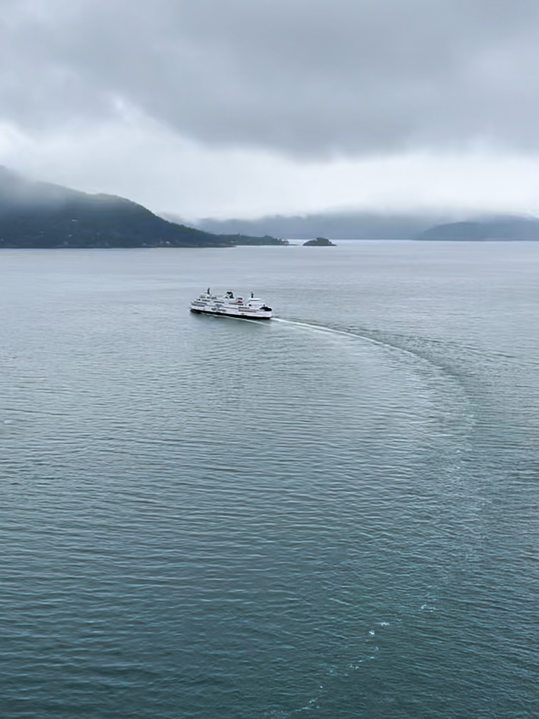
Horseshoe Bay is a small seaside community in West Vancouver which serves as a ferry terminal for car and passenger ferries to Bowen Island, Sunshine Coast, and Vancouver Island. While there isn’t much to do here, the views towards the water and mountains are incredible. It’s a great quick stop to snap some photos and grab a coffee for your journey.
To get there, you’ll need to exit Highway 99 and follow the signs to Horseshoe Bay Ferry Terminal. Once you find parking, head to the beach and pier to take in the stunning views of the harbour, Howe Sound, nearby islands, and the beautiful mountains in the background.
2. Horseshoe Bay lookout
This ‘secret’ lookout is an optional stop that requires a bit of a detour. We’d only recommend it if you’re looking for somewhere to watch the sunset, want to explore less touristy spots and don’t mind going a bit off the beaten path.
The lookout is only a small wooden platform, but you’ll have a beautiful view of the Horseshoe Bay, Howe Sound and the Sunshine Coast. Even though it’s not an official viewpoint, it’s popular with locals and people who discovered it on social media, so you most likely won’t have it just to yourself.
To park, you’ll need to pull into a lay-by on the side of Horseshoe Bay Drive which isn’t ideal. You’ll then have to walk for a bit along the road to find the viewpoint. You won’t be able to see it from the road as it’s hidden between the trees, but we marked the exact location on the map below. If you decide to come here, we highly recommend doing a bit more research online, so you definitely know how to find it and where to park.
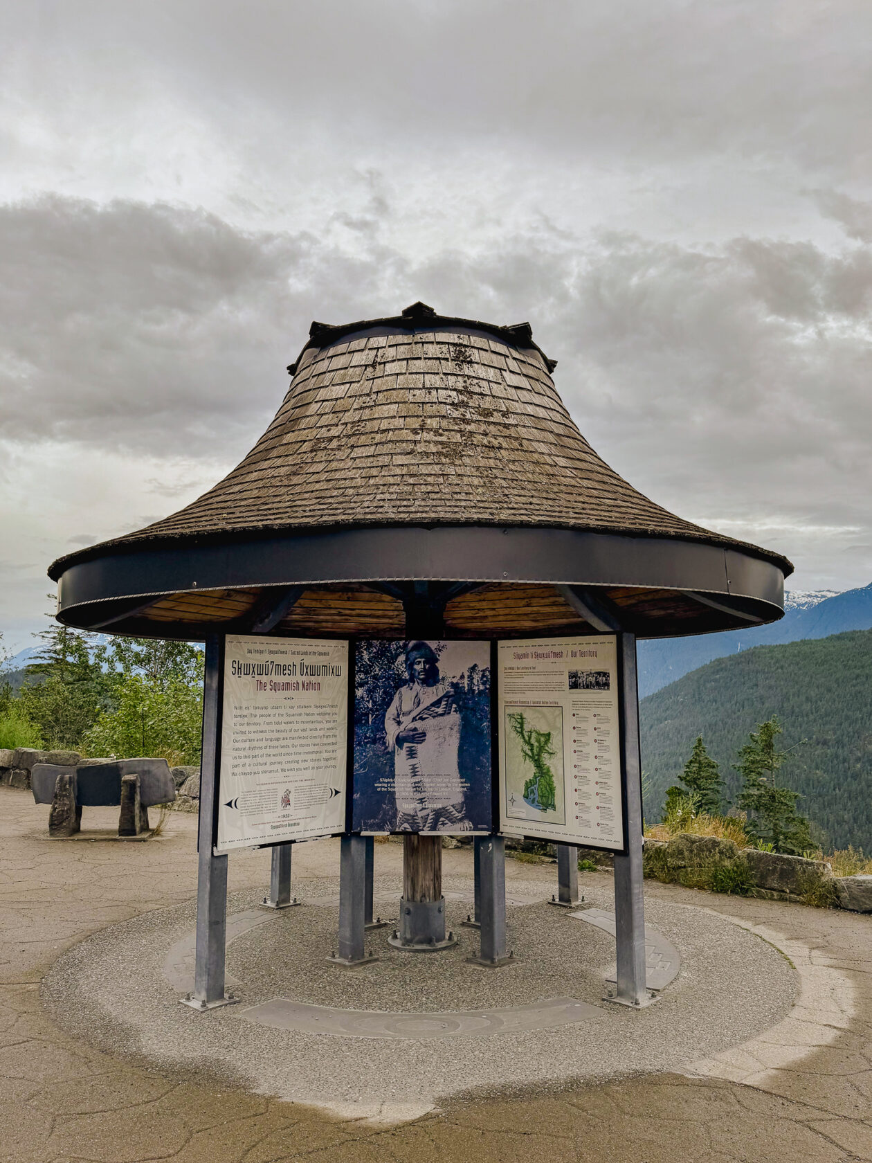
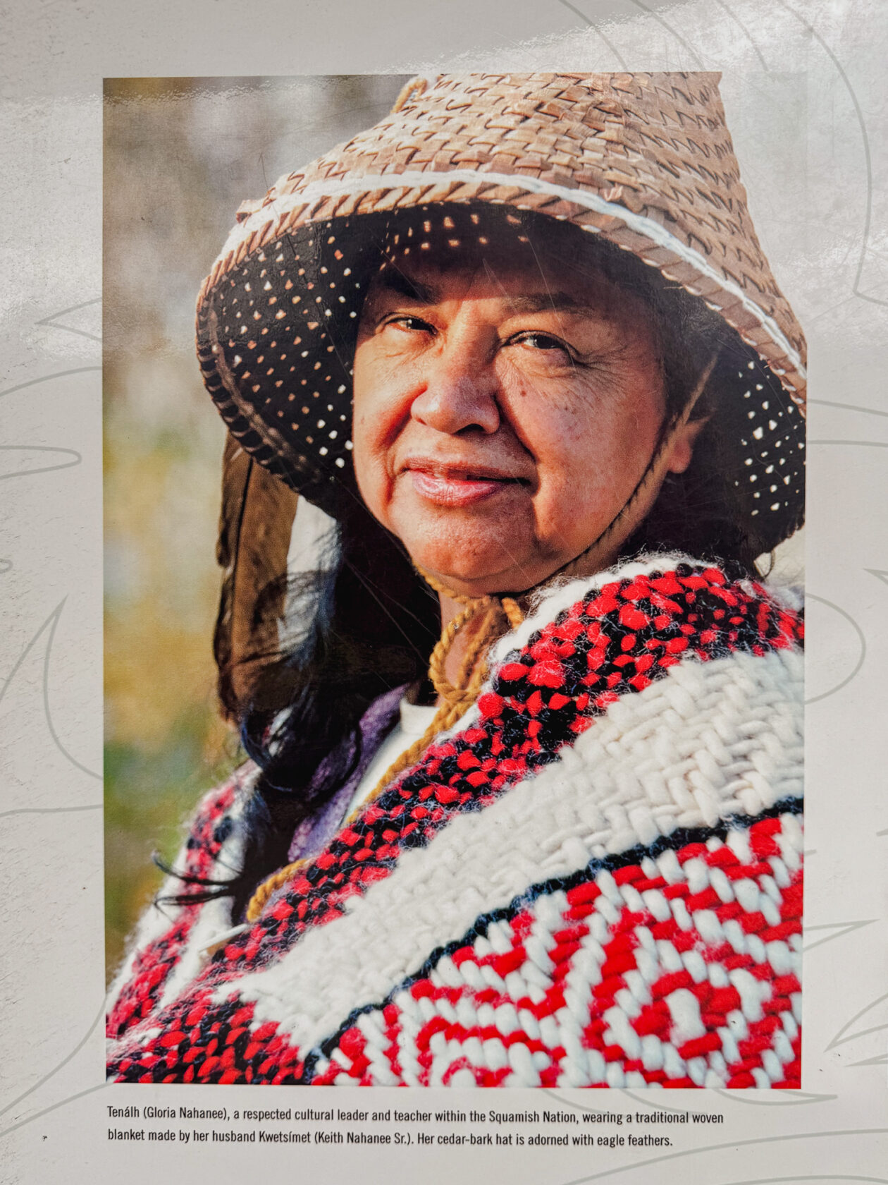
3. Cultural Journey interpretive kiosks
If you’re interested in learning more about the area and the rich culture of the local Squamish and Lil’wat First Nations, you can stop at 7 designated pullover stops along the route. At each stop, you’ll find an information kiosk with a unique roof designed to resemble a traditional First Nations woven hat. You can read about this self-guided tour and get a map of all the kiosks on the Squamish Lil’wat Cultural Centre’s website here.
Interesting to know: As you’re driving, notice that some of the signs and kilometre markers are themed in the local First Nations languages and motifs.
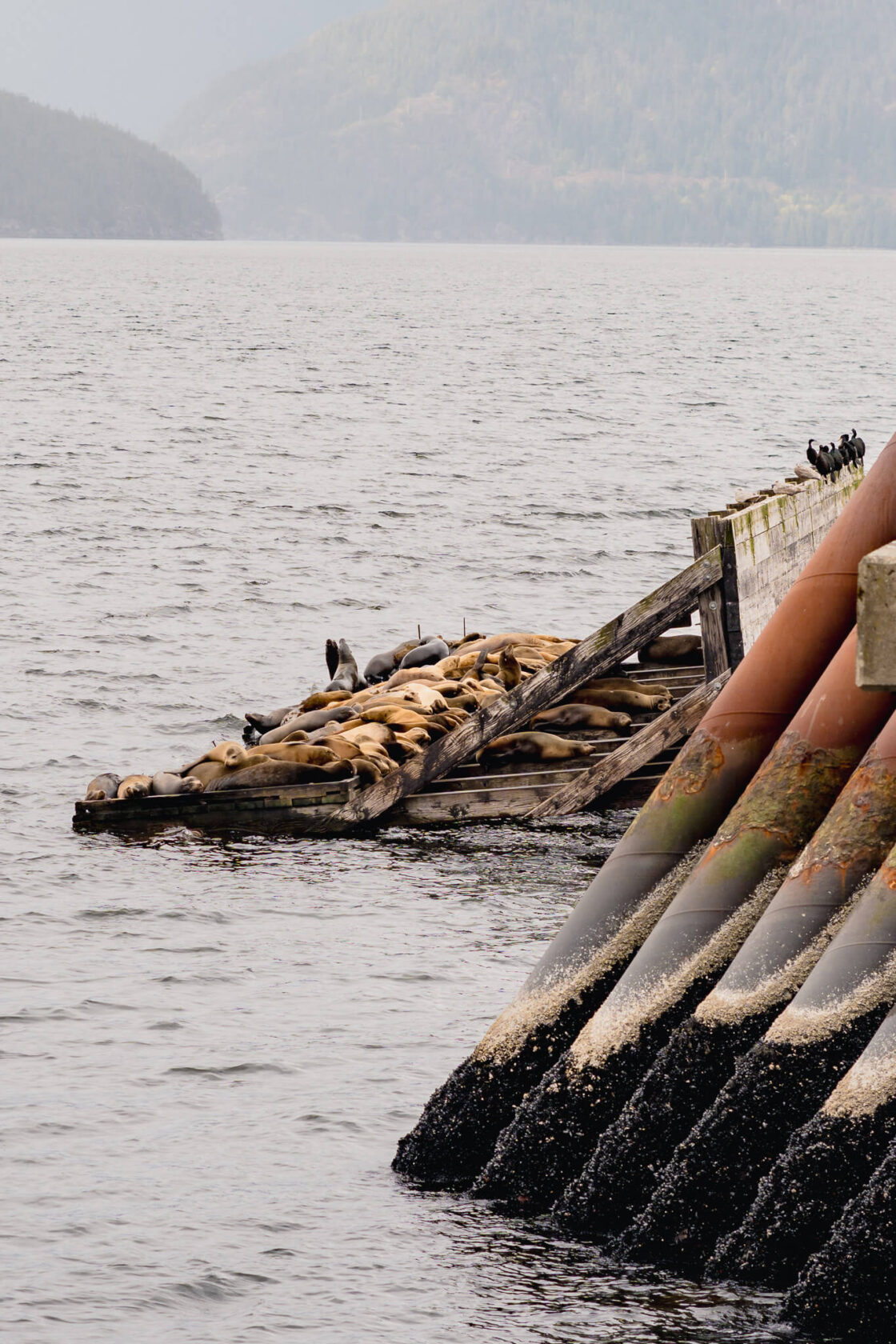
4. Porteau Cove
Porteau Cove Provincial Park is another nice stop just 20 minutes (25km) from Horseshoe Bay. You can take a short stroll along the pebble beach and if you’re lucky, you might see some sea lions. When we visited in February 2024, we saw a few dozen of them. They often gather at the end of the pier and pile on top of each other.
If you happen to be in the area in the evening or at night, Porteau Cove is a lovely spot for watching the sunset or stargazing, as there’s relatively little light pollution. When the northern lights were visible in May 2024, the highway was lined with cars for a few kilometres as everyone flocked to watch them from this spot!
There’s also a campsite right by the beach with spaces for tents and RVs. Just a heads-up: it’s incredibly popular, so be sure to book several months in advance if you plan to camp here.
Interesting to know: the pier is an emergency ferry dock in case the Sea to Sky highway becomes impassable due to a rock slide or earthquake.
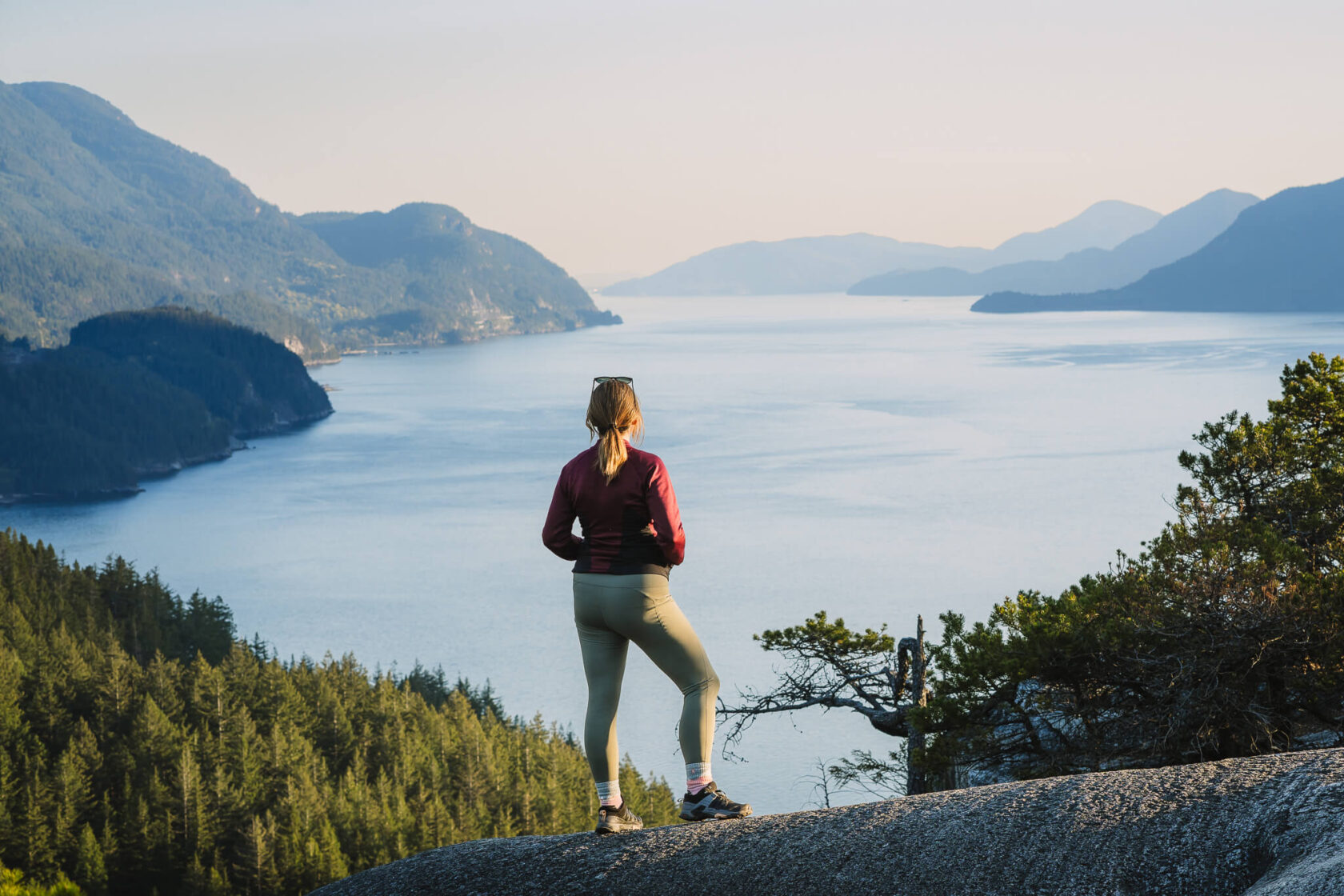
5. Quercus Lookout
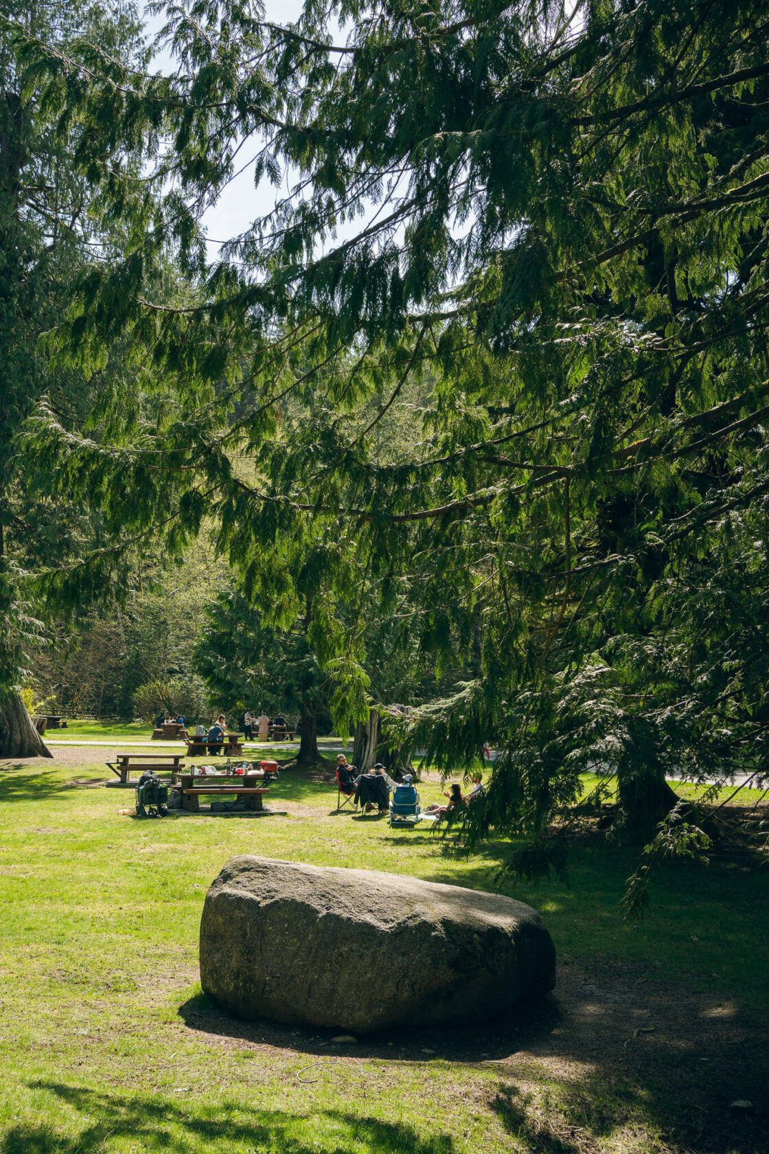
The next viewpoint, Quercus Lookout, is located in Murrin Provincial Park. The park has pretty much everything you may want for a great day outside: a swimming lake, forest to explore, picnic tables, hiking trails, beautiful viewpoints, and numerous world-class climbing walls. As a result, the car park is often full, especially on sunny weekends.
Quercus Lookout is a short hike (around 1.4 km there and back), but it’s also quite steep. If you’re not fit, this trail may challenge you, but it’s worth making the effort for the view. The terrain is mostly roots and rocks, and you’ll be climbing up a lot of wooden stairs. You’ll be between the trees the entire way, and you’ll most likely pass some rock climbers attempting to climb some of the large rock slabs along the route. It can take anything from 20 minutes to an hour to reach the lookout point, depending on your fitness. It’s not a race, so bring water, take it slow, and stop as much as you need to along the way.
Once at the top, you will be rewarded with an amazing view of Howe Sound. The view is different than from the Chief or the Sea to Sky gondola as they overlook Howe Sound towards the west. Here, you’re looking south towards Vancouver.
Bear in mind that there are a lot of trails in this area (many of them are access routes for climbers), and they’re often poorly marked, so using an app like AllTrails is a must! It’s a short hike, yet people often get lost here.
If you’re staying in the area and have more time, you can attempt the Jurassic Ridge hike (Quercus Lookout is one of the stops along the route). It’s a considerably longer hike (over 3 km), and the trail can be challenging for some people, so don’t underestimate it just because it’s short! It has quite a few sections with ropes and chains, some easy scrambling, and a lot of big rocks which can be very slippery when wet. Going clockwise is easier as you will be going up on the rope sections, but the views are nicer when you’re going counter-clockwise as you will have views of Howe Sound on the open sections. There’s no right answer here; you have to choose your own adventure 🙂
Location: west side of the highway (on the left when coming from Vancouver). There is a left turn.
Time of year: year-round, but the rocks at the lookout may be slippery after rain or icy in winter. Check the BC Parks website for opening hours and other advisories.
Hiking guide: Quercus Lookout
Facilities: pit toilets in the parking lot
What you’ll need: offline map, water and shoes with good grip.
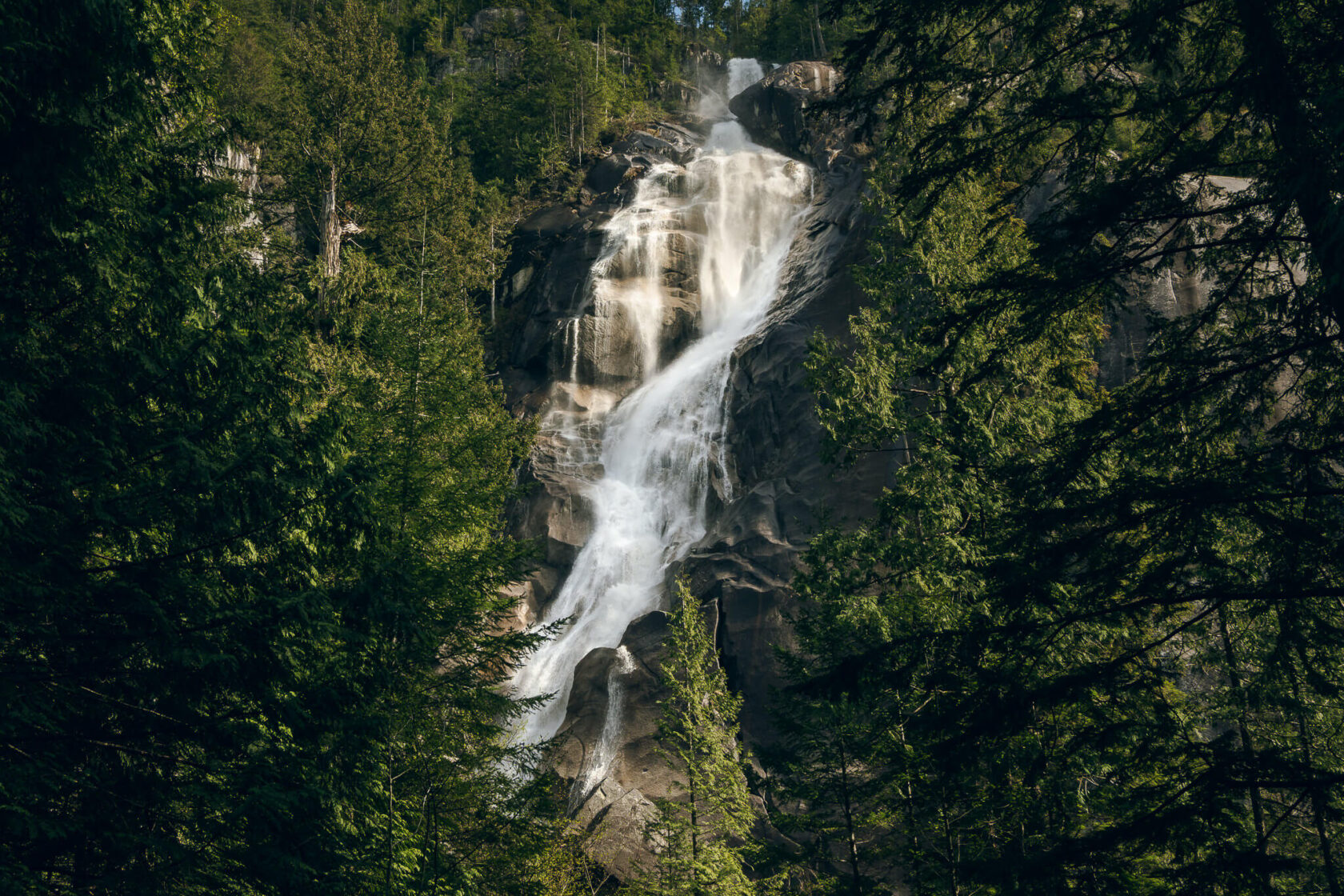
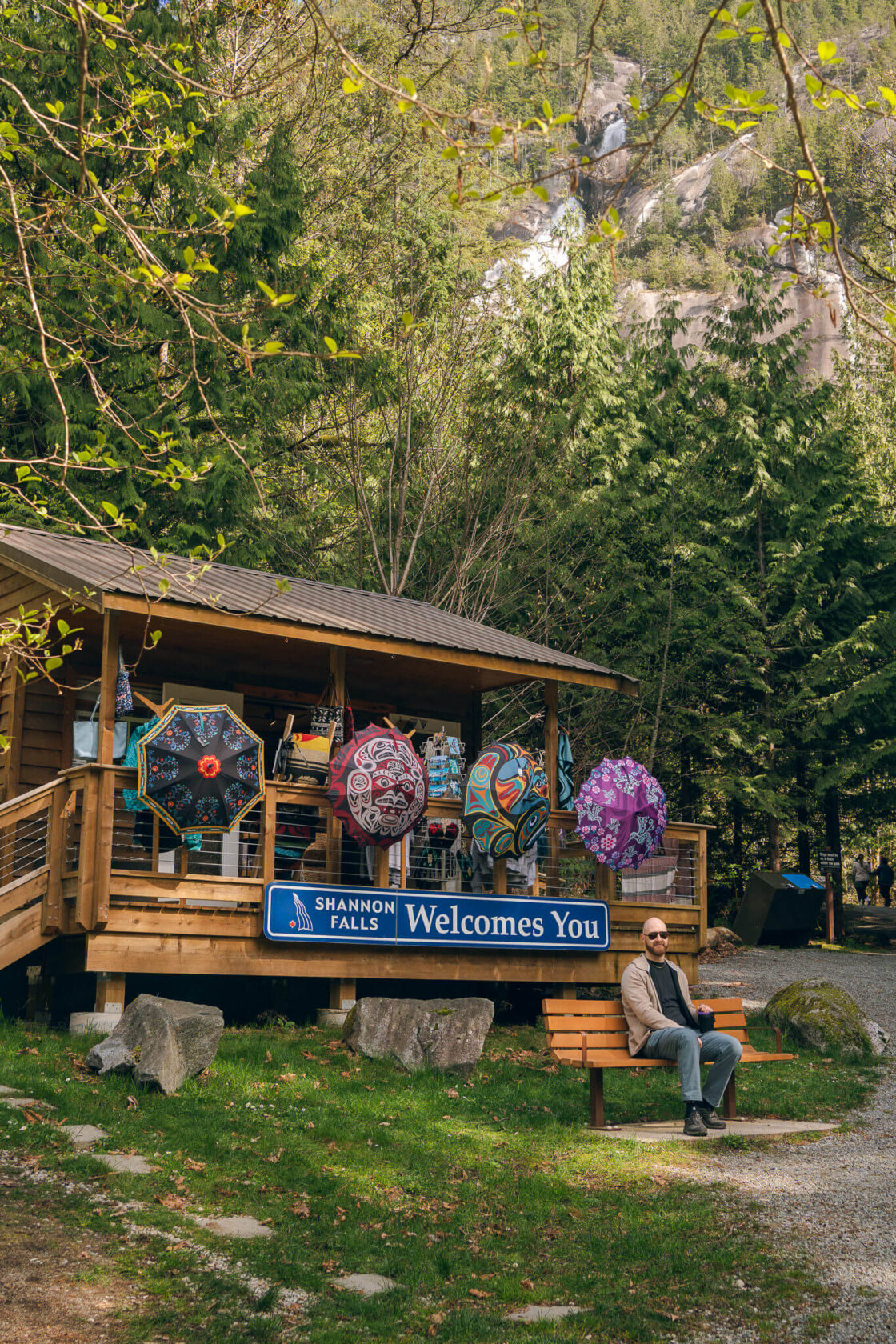
6. Shannon Falls
A stop at Shannon Falls is a must, even if you’re short on time! Standing at 335 metres, it’s the third-highest waterfall in British Columbia. Although the entire waterfall isn’t visible from the viewpoint, it’s still incredibly impressive.
Parking is right by the highway and the waterfall is just a 5 minutes walk away on a well-maintained gravel path. For that reason, it’s usually busy with tourists. If you’re visiting in summer, the number one tip we would give you is to arrive early as parking can be a nightmare. If you’re having trouble finding a space, you can try the Stawamus Chief or Sea to Sky Gondola parking lots as there’s an easy hiking trail that connects all three.
There are many great hikes in this area as well. If you have time, you can hike to the Upper Shannon Falls, or do another popular hike like Stawamus Chief Trail or Sea To Summit Trail. All three trails are long and challenging, often with chains and ropes, so they’re not suitable for inexperienced hikers.
There are also multiple fantastic climbing routes ranging in difficulty, but they’re not marked, so it’s best to get directions from the welcome centre.
Location: east side of the highway (on the right when coming from Vancouver)
Time of year: year-round, but check the BC Parks website for opening hours and other advisories.
Facilities: washrooms, picnic areas, welcome centre
Good to know: the flow of water is the strongest in spring, so the best time to visit is April or May. That being said, this waterfall is ALWAYS beautiful.
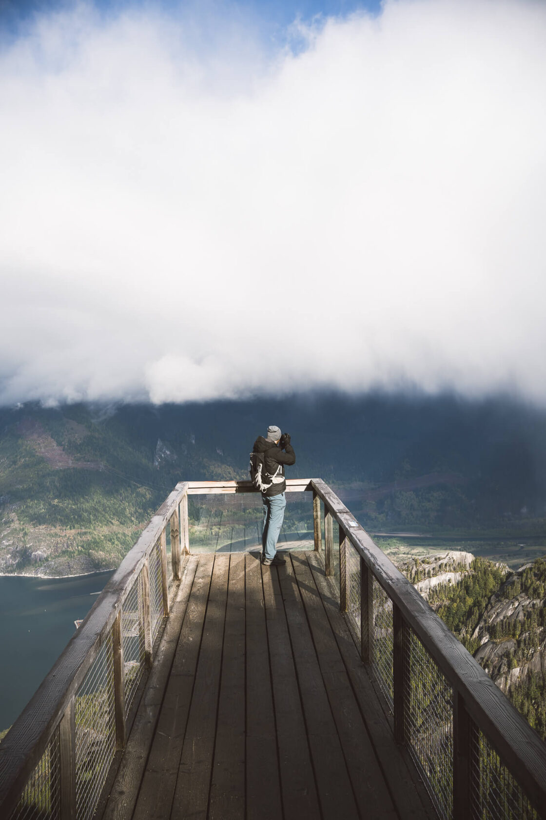
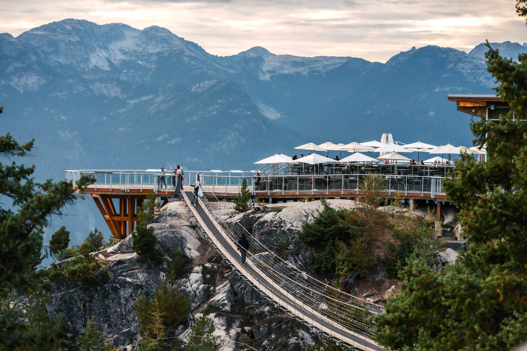
7. Sea to Sky Gondola
Right next to Shannon Falls is one of the main highlights of the Sea to Sky Highway, the Sea to Sky Gondola. The gondola whisks you up the mountainside to 885 metres in just 12 minutes, so it’s a great way to see the surrounding landscape from a higher vantage point with zero effort. As Vancouver locals we’ve visited it several times and still can’t get enough of the views from the top.
The cabins are pretty much all windows so the ride itself is fantastic. As soon as you step onto the sun deck at the top, you’ll get mind blowing views of Howe Sound, the coastal mountains, Stawamus Chief, and the lush forest below. You’ll also see the gondolas coming and going.
On the other side of the sun deck you’ll find a suspension bridge with views of Sky Pilot and Copilot mountains. There are several short walkable trails, with Panorama Trail being the most popular as it takes you to the Garibaldi Park viewpoint and the Chief & Squamish viewing platform which you simply cannot miss. If you’re here to hike, consider Al’s Habrich Ridge Trail which is around 7km round trip with even more stunning views. After exploring, finish off on the sun deck with some drinks or lunch from the restaurant or bring your own snacks and drinks. It honestly feels like dining at the top of the world.
The only downfall of the Sea to Sky Gondola is that tickets are quite pricey at $70 per person, but you can also purchase evening tickets valid from 4 p.m. for $45 (prices last checked in 2024). That being said, in good weather the Sea to Sky Gondola is 100% worth the price.
If you’re planning to visit the Sea to Sky Gondola in the summer, we recommend booking your tickets a couple of days in advance as they sell out quickly. And make sure you check the website for the opening times, as the last download is often before sunset.
Location: east side of the highway (on the right when coming from Vancouver)
Preferred weather: sunny / partly sunny (otherwise you’ll be paying for no views)
Time of year: year-round, but check the Sea to Sky gondola website for opening hours and advisories
Facilities at the bottom of the gondola: water station, washrooms
Facilities at the top of the gondola: restaurant and cafe, washrooms, gift shop
Tickets: you can book your tickets here
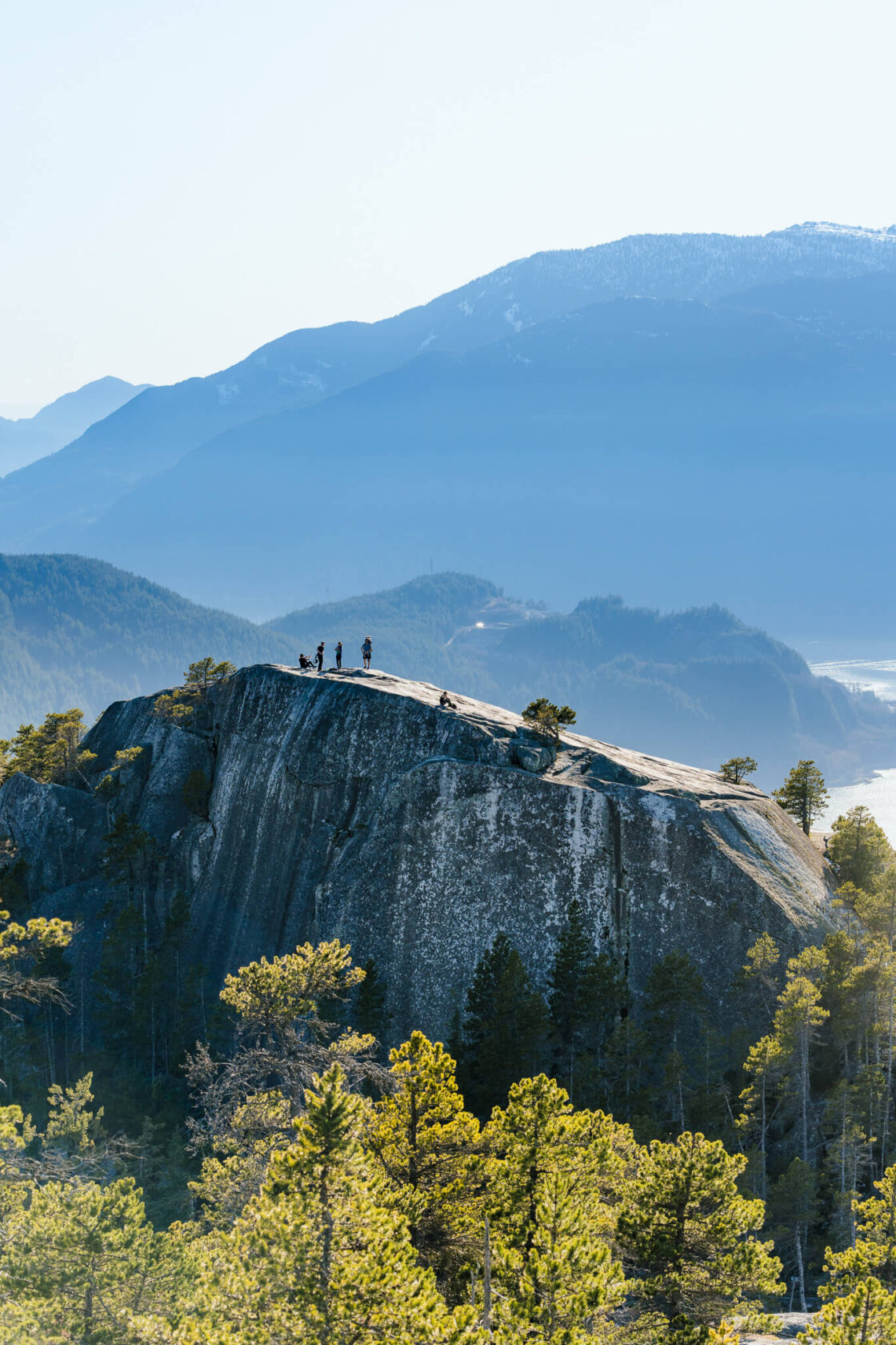
8. Stawamus Chief
As you drive into Squamish, you’ll see one of the biggest granite monoliths in North America, the Stawamus Chief (referred to by locals as the Chief). If you’re lucky, you might spot paragliders soaring next to it, or rock climbers attempting to climb its rock face. But most people come here to hike to the top for an incredible view of Howe Sound. The hike is physically challenging and it may take anything from half to full day depending on your skill level. If you have only one day on the Sea to Sky highway and want to visit other stops as well, keep this in mind. If you just want to admire the Chief from a distance, simply take a stroll through downtown Squamish. There’s also the Chief viewpoint at the top of the Sea to Sky Gondola (paid attraction).
A few words about the Stawamus Chief hike:
The Chief towers 702 m (2,303 ft) above Squamish. Because of its steepness, it’s often compared to the famous Grouse Grind in North Vancouver, but it’s a completely different type of hike, much more rugged and adventurous. It has three summits, with summit 1 and 2 offering the best views. The traverse between the first two summits may be challenging for some, as it involves ladders and chain sections. Just because it’s a popular hike and not particularly high, it doesn’t make it easy! 😉 Before heading out, check the BC Parks website for info about the trail and any closures.
Location: east side of the highway (on the right when coming from Vancouver)
Time of year: year-round, but check the BC Parks website for advisories
Facilities: washrooms, picnic benches, drinking water
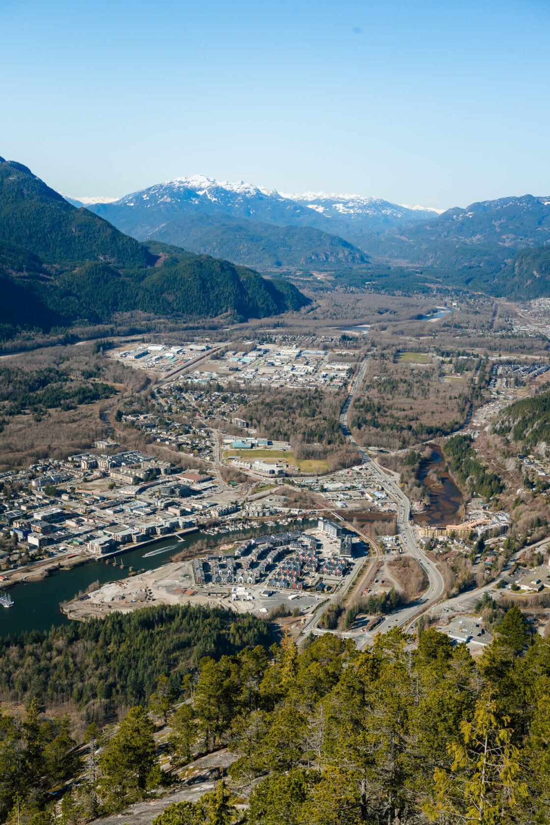
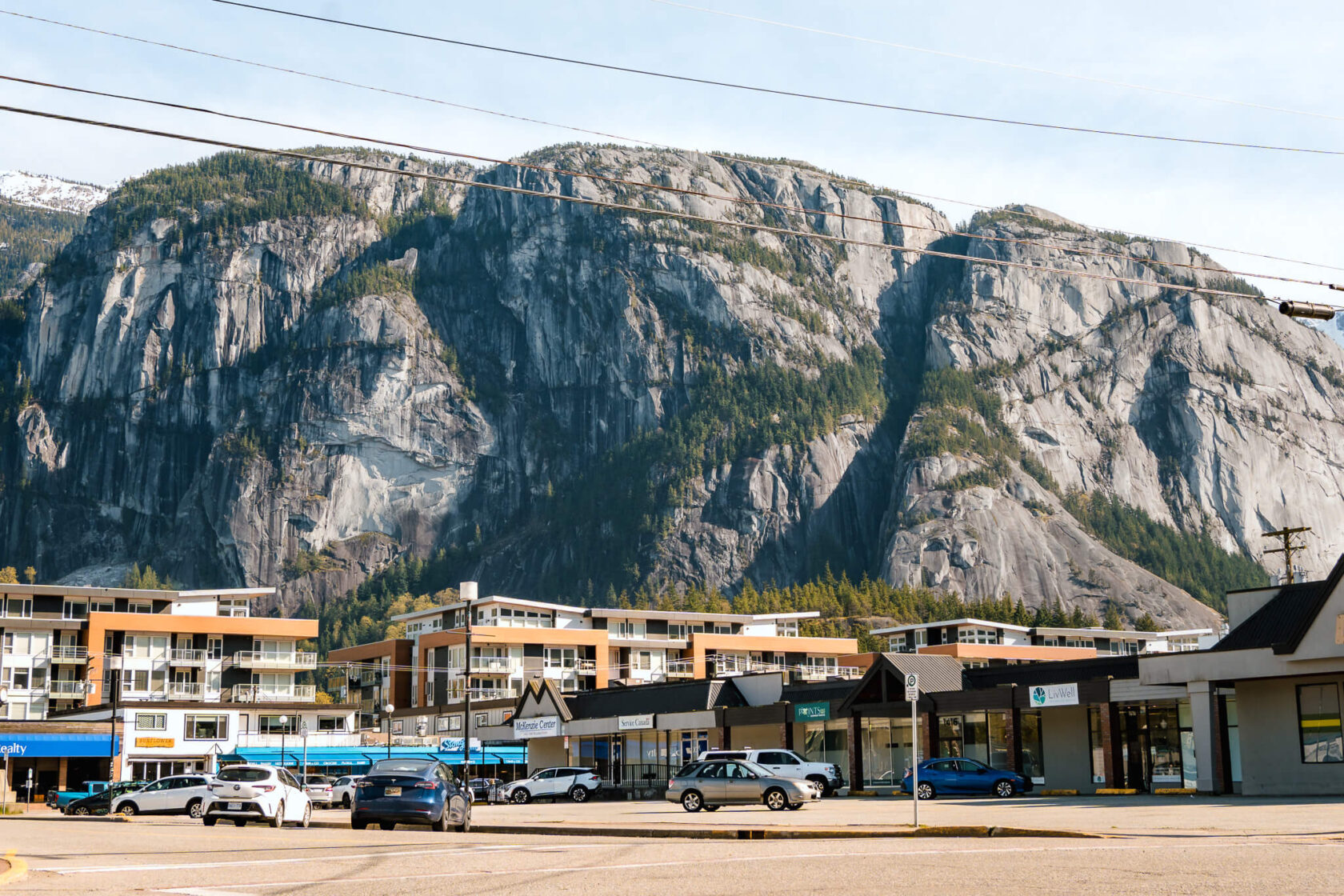
9. Downtown Squamish
Right after the Chief and at the end of Howe Sound, you’ll find the small adventure town of Squamish. The face of The Chief towers over the town, and you can see the characteristic shape of Mount Garibaldi and the notoriously dangerous Atwell Peak in the distance.
We hadn’t heard of Squamish before moving to Vancouver, and chances are you haven’t either, as most travel guides focus on Vancouver and Whistler. But if you like the outdoors, you’ll be hard-pressed to find a better location in British Columbia or even Canada. You can do pretty much all kinds of outdoorsy activities here – hiking, rock climbing, kayaking, mountain biking, mountaineering – you name it. You can even take a helicopter ride to some amazing locations for skiing, boarding, fishing, or mountaineering. Needless to say, if you love adventure but not the crowds, Squamish is a perfect base for exploring the area.
If you’re only passing by, Squamish is a great place to grab some food, try some of the excellent craft beer options, buy new hiking gear, or simply admire the views.
For local info about the area, maps and things to do, stop at the Squamish Recreation/Tourist Centre.
Good to know: The road signs say “Sḵwx̱wú7mesh” because Squamish used to be a First Nations community. If you’d like to learn more about their vibrant culture, visit the Squamish Nation website.
10. Brackendale
At the north end of Squamish, you’ll find the small riverside community of Brackendale. If you’re in the area around October/November, it’s worth stopping by for the annual gathering of bald eagles that arrive here for the salmon runs. Even outside of this season, it’s a lovely place for a walk along the river and to enjoy some food at The Watershed Grill. If you’re a fan of Netflix’s drama series ‘Virgin River’ you’ll instantly recognize it, as it was used to film the exterior shots of Jack’s Bar.
Location: west side of the highway (on the left when coming from Vancouver). There is a left turn.
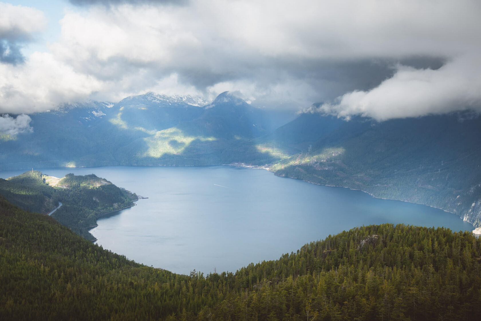
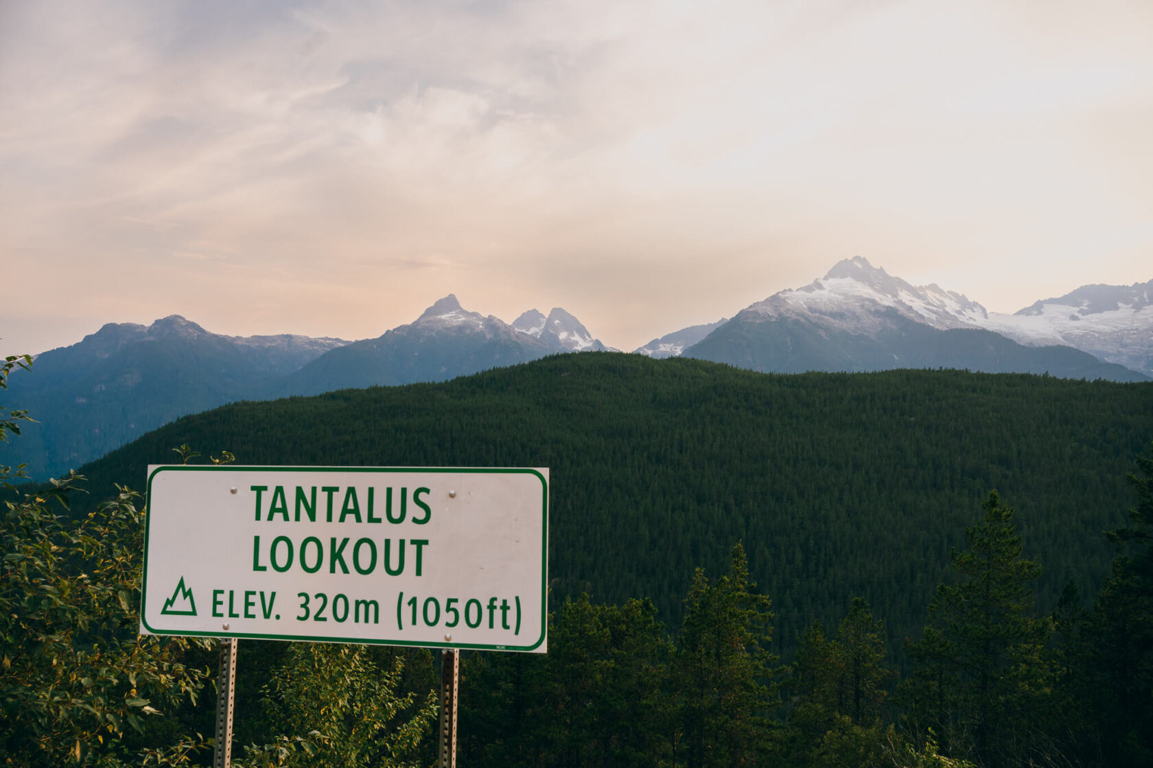
11. Tantalus Lookout roadside viewpoint
The Tantalus Lookout is one of the best places to stop along the Sea To Sky Highway to take in the beauty of the landscape. You don’t want to miss it, especially if you’re not a hiker and don’t usually get to enjoy mountain ranges!
From the lookout, you’ll get to see the majestic snow-capped peaks and glaciers of the Tantalus Range, including its highest peak Mount Tantalus. The view is completely unobstructed and directly in front of you, and you’re high enough to see down to the river valley below. We stopped here on our first road trip at sunset and we couldn’t get over the view, which is particularly spectacular between late fall and early spring when the peaks are completely covered in snow.
There is parking for only a few cars, but most people only spend 5-10 minutes so new spaces are pretty much always popping up.
Location: When driving north from Vancouver, Google Maps may direct you to the Tantalus Lookout viewpoint on the right-hand side of the highway, but it’s not a great viewpoint. The much better view is on the opposite side of the highway. There is no left turn and you can’t cross over, so make sure to stop here on your way back to Vancouver. If you’re lucky, you might catch a beautiful sunset. Pay close attention to the signs because there isn’t much else exciting on this stretch of the road and you won’t see the view until you’ve passed the viewpoint.
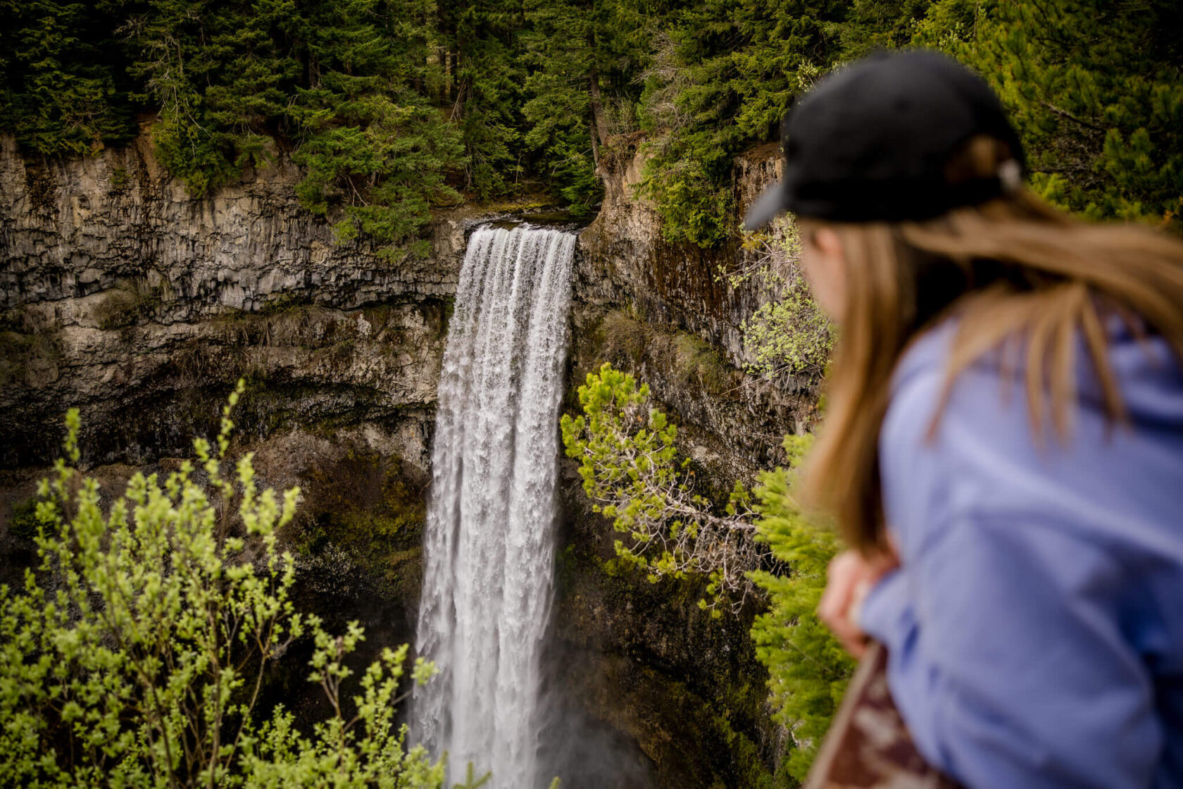
12. Brandywine Falls
Brandywine Falls is another quick stop that’s easy to fit in your trip plan. Although not as grand as Shannon Falls, Brandywine Falls is incredibly gorgeous and definitely worth the visit. This 70-metre waterfall is best viewed from the Brandywine Falls Viewpoint, accessible via a well-marked trail from the parking lot. The walk to the waterfall is short and easy, only about 15 minutes on flat terrain.
There used to be an unofficial trail to the base of this waterfall but it’s closed now and there are fines for attempting to hike down!
Location: east side of the highway (on the right when coming from Vancouver)
Time of year: May 1 – October 31 (see advisories on the BC Parks website)
Facilities: free parking, washroom
13. Whistler
The resort village of Whistler needs no introduction. It’s home to one of the most renowned ski resorts in the world, Whistler Blackcomb – a skier paradise, with extensive trails and fresh powder early in the skiing season. Even though Whistler is mostly known as a winter destination, in the summer it becomes a heaven for outdoor enthusiasts. There’s SO MUCH to do here!
Shopping in Whistler village
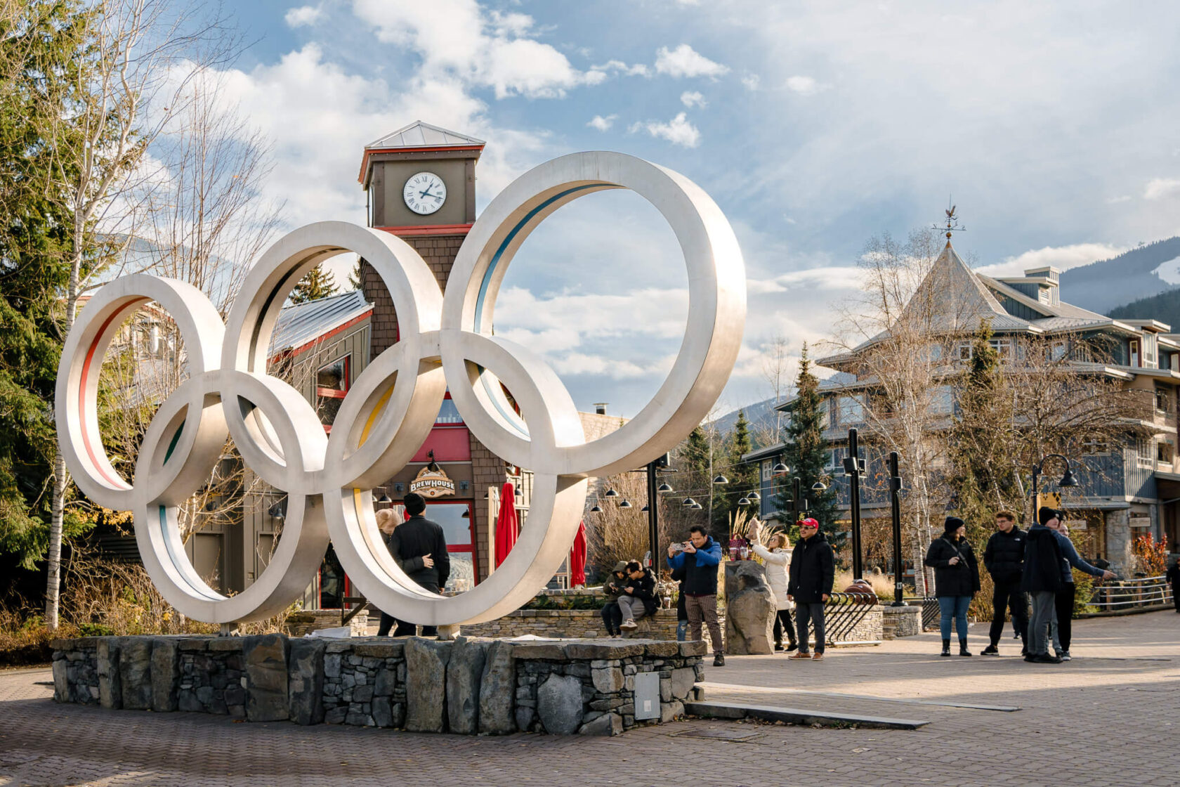
One of the most obvious things to do in Whistler is walking around the Whistler Village. One area, the Village Stroll, is pedestrian-only and lined with bars, eateries and cafes, but also a lot of cool shops offering everything from sports gear to artwork. The town has a really nice vibe which a lot of people say is a mix of European and alpine feel.
As you explore, don’t forget to take the obligatory picture with the 2010 Olympic Rings, though in summer, you might have to wait your turn.
In late spring, the glacial stream that runs through the village turns into a gorgeous milky blue, a colour so beautiful that it almost doesn’t look real.
Peak to Peak 360 Experience
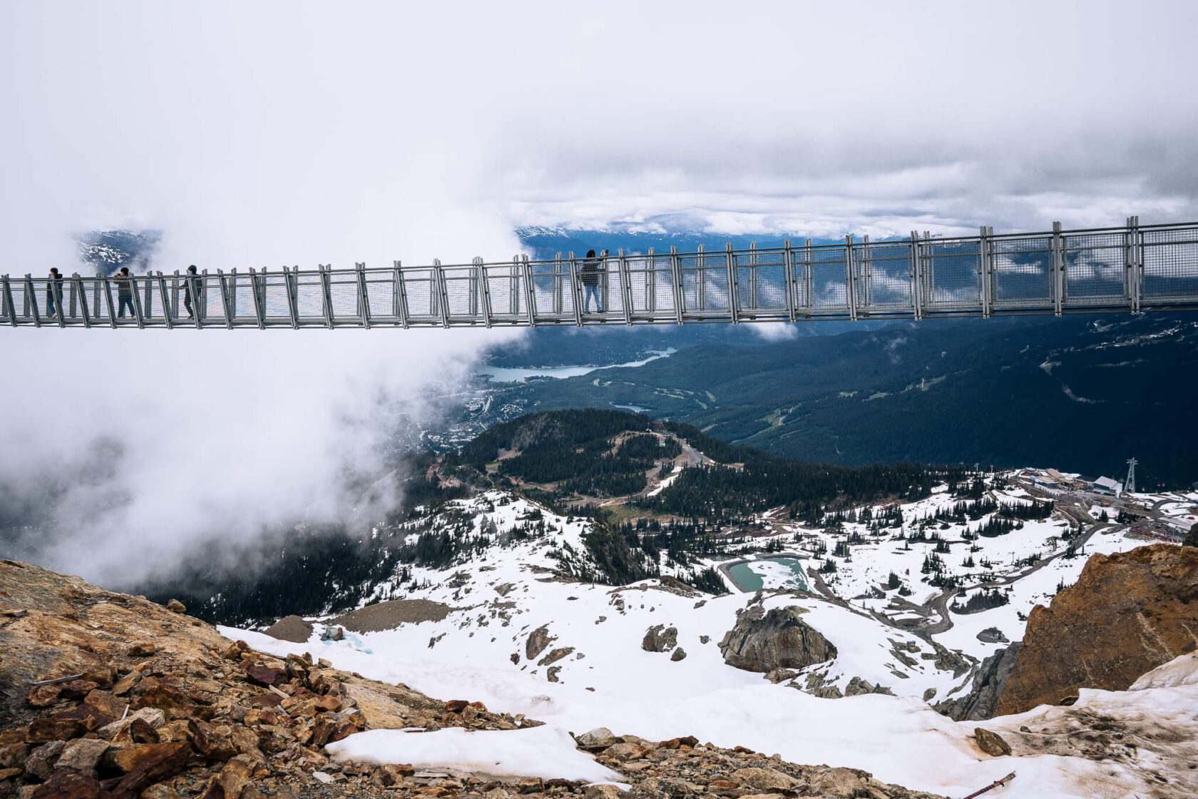
A visit to Whistler isn’t complete without experiencing the Peak to Peak Gondola which connects Whistler and Blackcomb Mountains. When the gondola first opened in 2008, it set three impressive records, including being the highest and longest lift system of its kind in the entire world. The journey takes just 11 minutes, and you’ll be soaring 436 metres (1,430 feet) above the valley. You can start your adventure at Blackcomb Gondola in Upper Village and finish on the Whistler Gondola in Whistler Village, or the other way round.
When you’re at the summit of Whistler Mountain, the views are simply spectacular, with panoramic vistas of snow-covered peaks and glaciers in every direction. There’s also a 130-metre long Cloudracker suspension bridge. It’s a little wobbly but a fantastic experience if you’re not scared of heights. For an extra dose of adventure, you’ll have the option to take an open chairlift – perfect for those seeking a bit of adventure.
If you have mobility issues, or are scared of riding the chairlift, give the Blackcomb Resort a call to help you plan your day.
Bear viewing tours
If spotting bears in the wild is on your bucket list, Whistler and Blackcomb mountains are home to around 60 black bears and their cubs. You can often see bears from the gondola, especially in the spring, but to get close to these incredible creatures you’ll need to go on a bear viewing tour. You can find more information here.
Ziplining
If you have time, one of the most adventurous things you can do in Whistler is ziplining. There are a few different options, including the longest zipline in North America sitting at over 2 kilometers (1.3 miles) long! You will be flying 100 kilometres per hour (62 miles) over forests and mountain tops with the highest point 183 metres (600 feet) off the ground! What more can we say? This is the ultimate zipline experience!
Alpine hiking trails
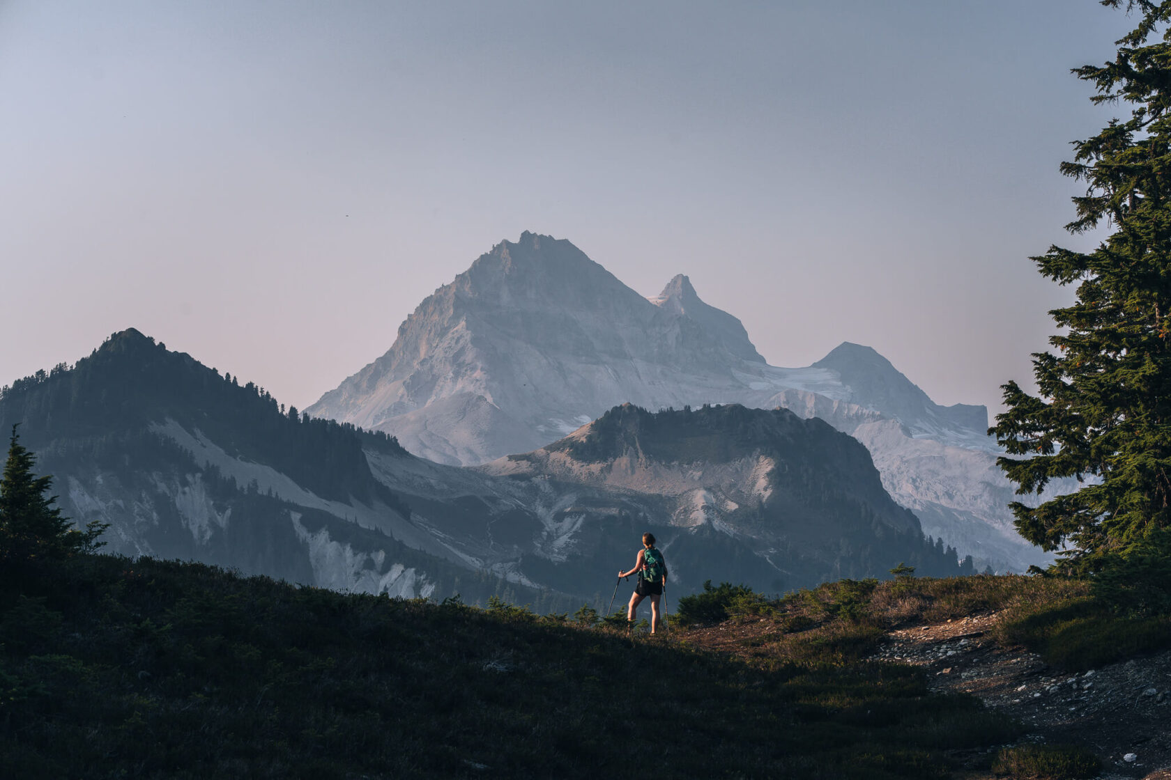
Whistler offers some of the best alpine hiking in Canada. With access to over 50 kilometres of trails via the Whistler and Blackcomb Gondolas, there’s something for everyone, from easy routes ideal for beginners to challenging full-day hikes for the adventurous. Our top pick is the High Note Trail, with stunning views of Black Tusk, Garibaldi Provincial Park, and Cheakamus Lake.
Garibaldi Provincial Park
If you stay in Whistler for a while, spend a day or more hiking in Garibaldi Provincial Park, an extensive wilderness spanning over 1,950 square kilometres. It boasts some of British Columbia’s finest hiking trails, including iconic routes like Panorama Ridge, Black Tusk, Garibaldi Lake, Elfin Lakes, and Wedgemount Lake.
If you want to camp at one of these locations, It’s essential that you book a spot in advance through the BC Parks website. By advance we mean a few months (typically in January for spring and summer). If you’re doing a day hike, you may need a free day pass from BC Parks. Again, book as soon as the booking window opens as passes go within seconds.
Garibaldi Provincial Park is a rugged wilderness teeming with bears and other wildlife, so proper preparation and equipment are crucial for any hike in the area.
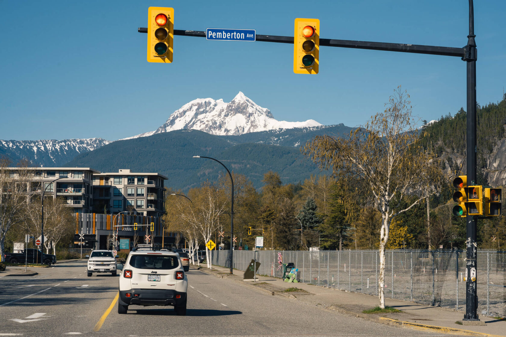
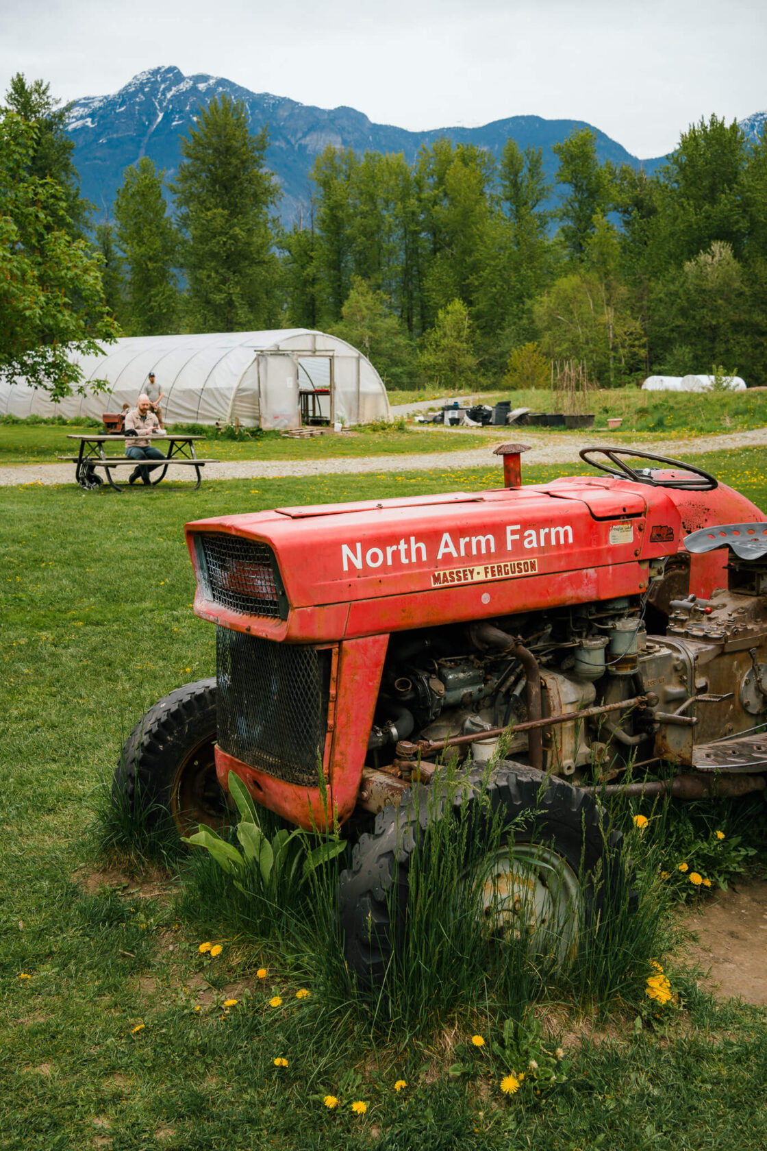
14. Pemberton
It took us a year before we finally stopped in Pemberton, a quaint little town most people use as a base for outdoor adventures. If you’ve made it this far, there are a couple of organic farms nestled among the mountains where you must stop for food and drinks.
First up is North Arm Farm, situated at the foot of Mount Currie. The setting is incredible, ideal for enjoying breakfast or lunch while soaking in the view. We had a garlic and potato soup – it was very simple but tasty. During the right season, you can even pick your own strawberries and blueberries to take home.
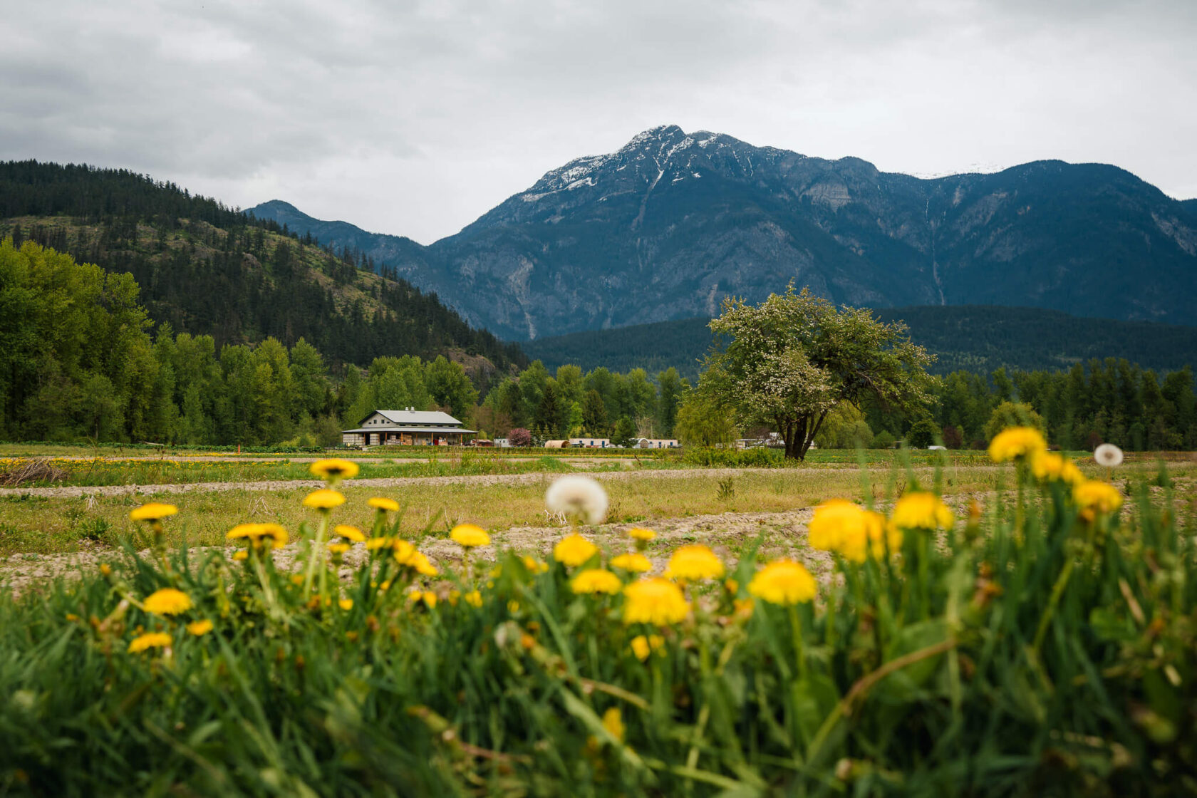
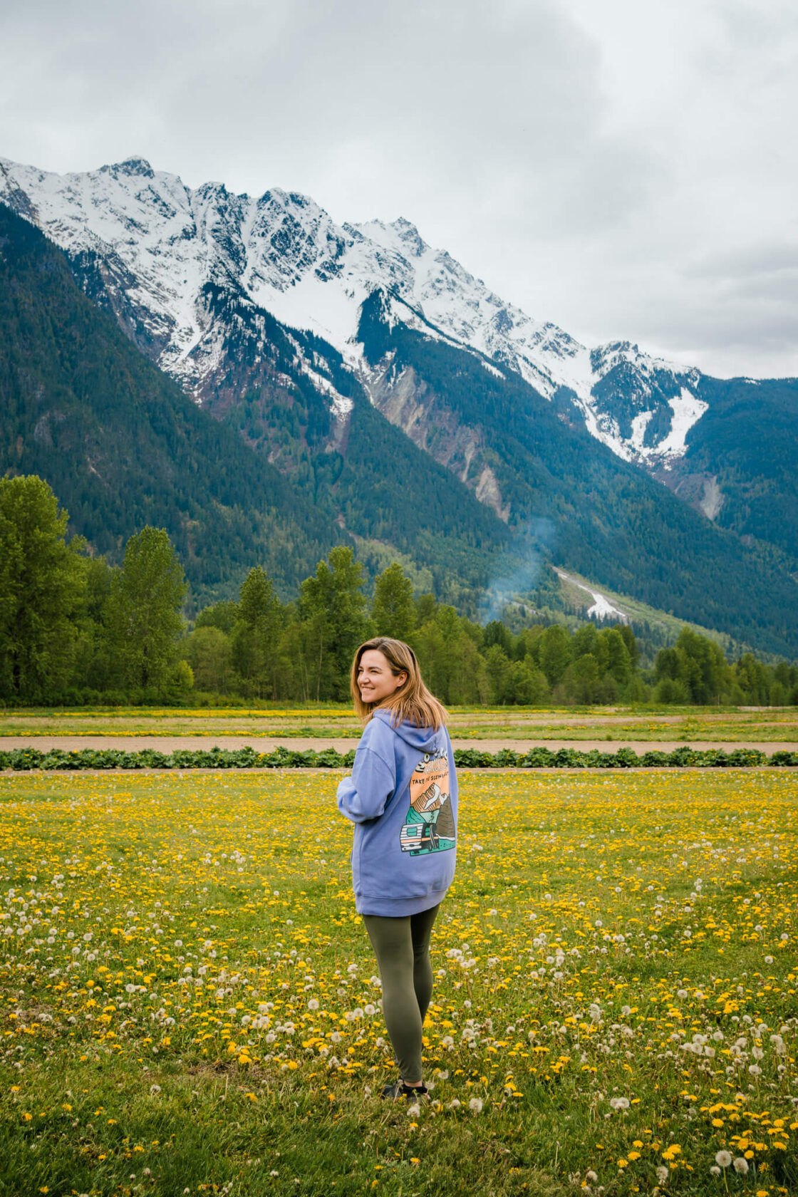
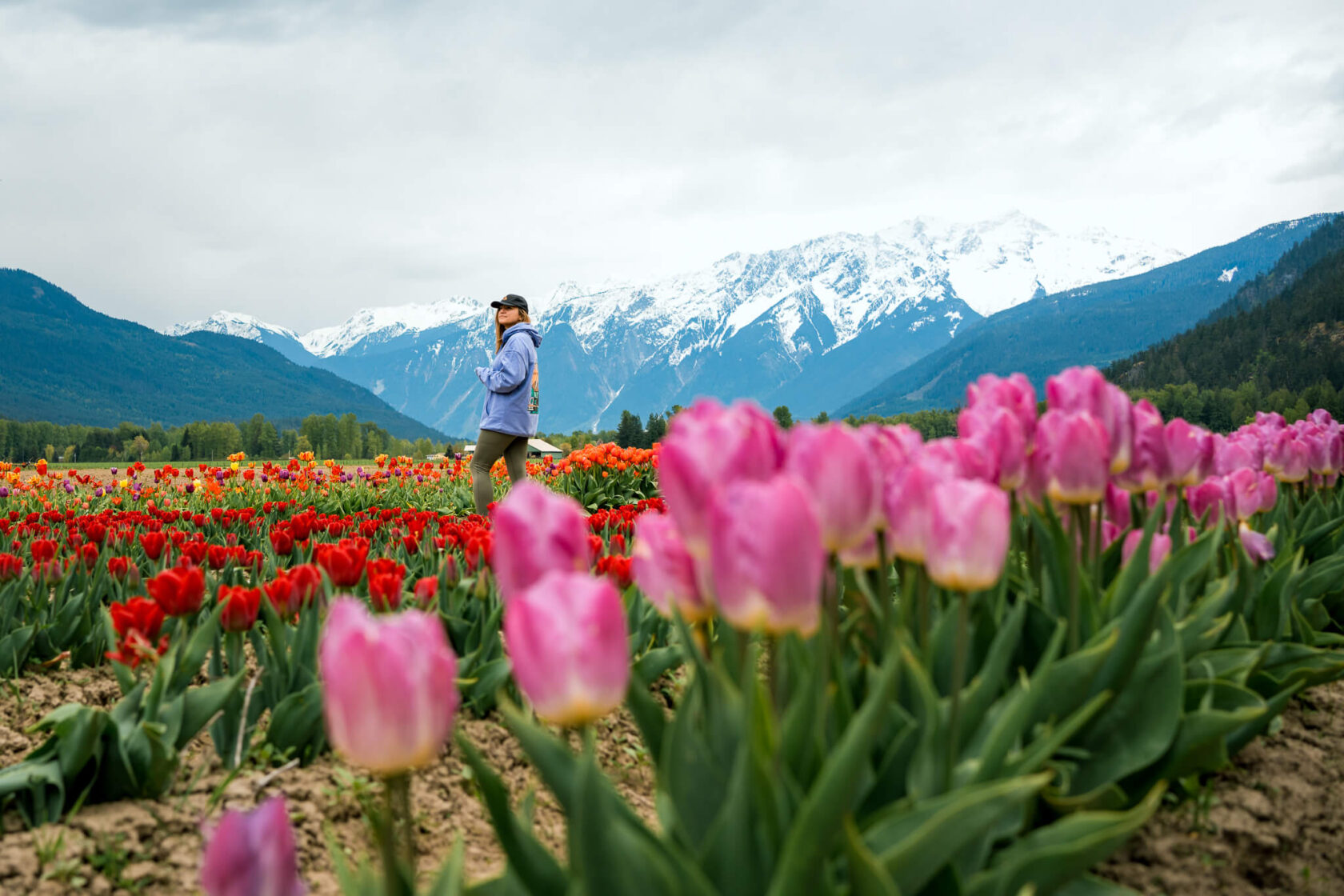
Our next recommendation are The Beer Farmers. We stopped here after a hike and had veggie burgers (that weren’t mushy!) with a flight of their house-brewed beers. The hibiscus sour was so good that we stocked up for home! If you’re here in May, don’t miss the tulip patch, set against snow-dusted mountain peaks – it’s truly stunning.


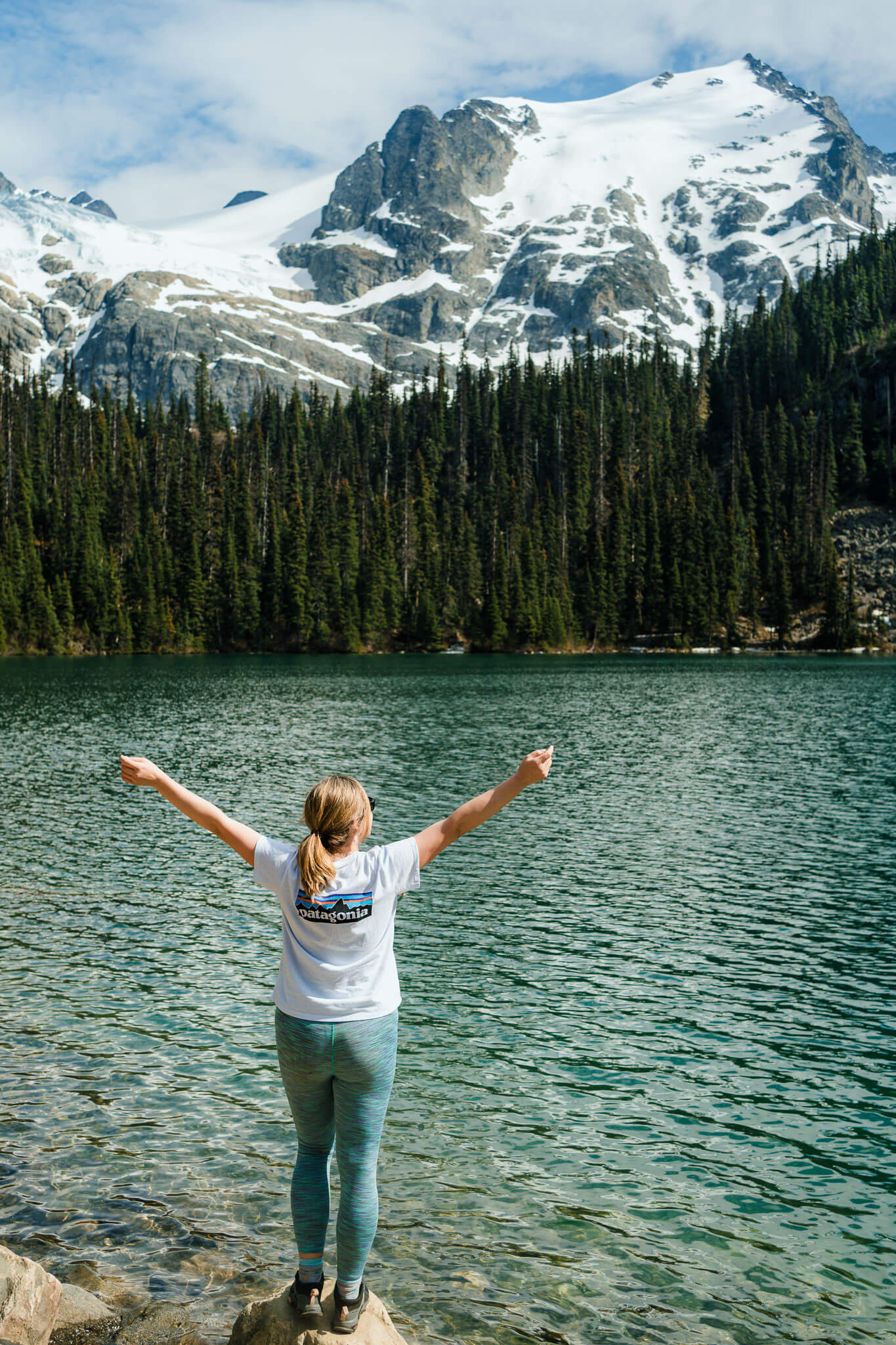
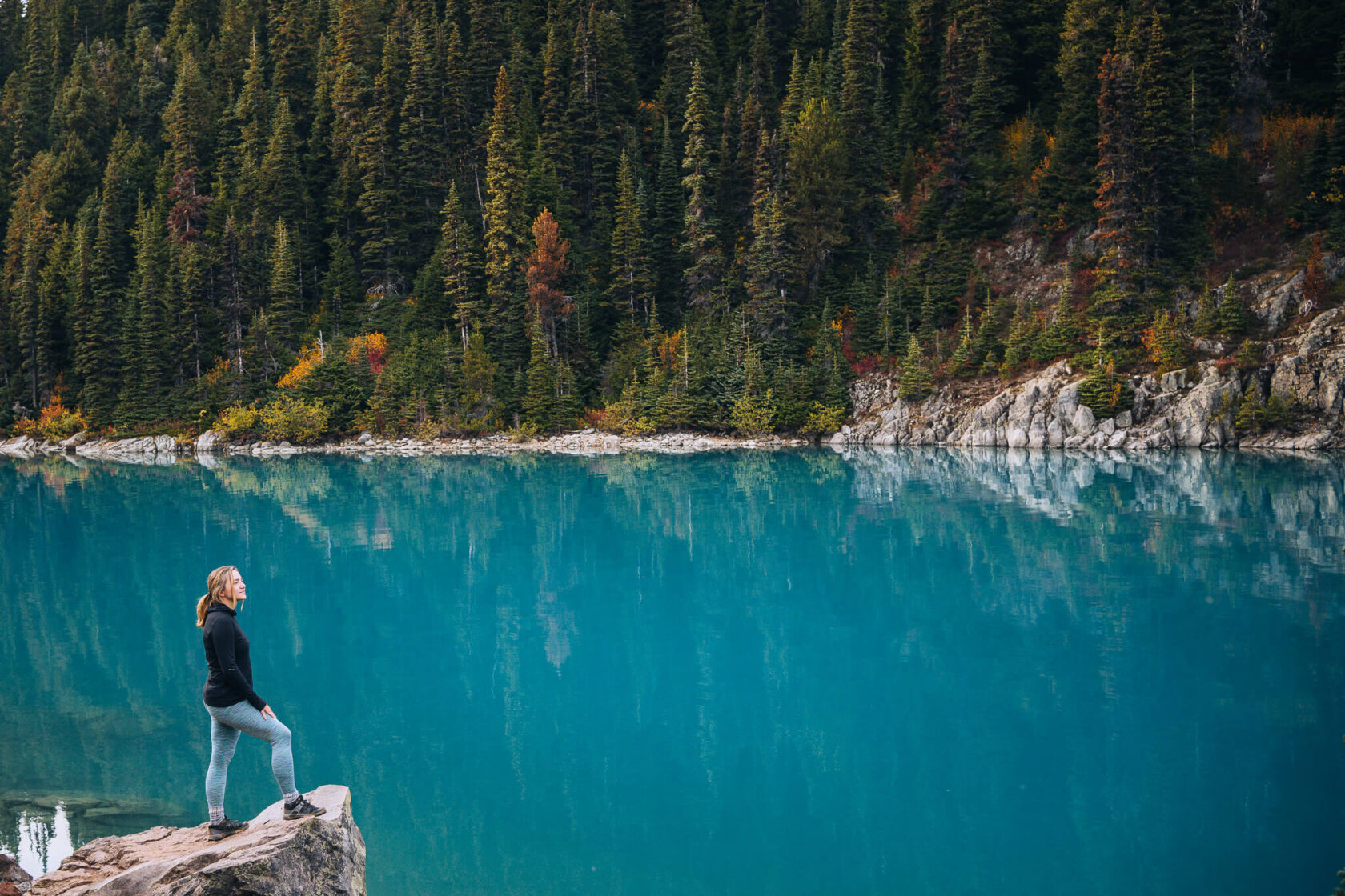
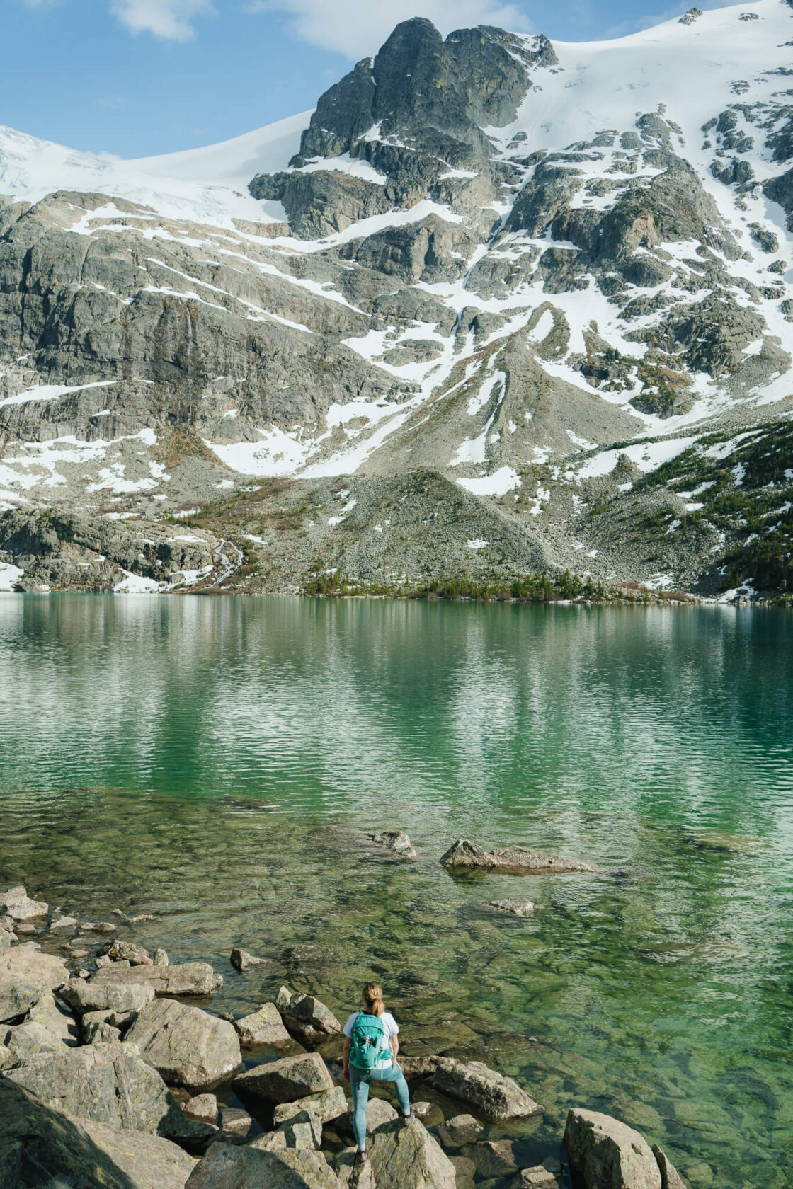
15. Joffre Lakes: a must-do hike
Joffre Lakes is an incredibly popular hike with three lakes and breathtaking views. It was one of the first hikes we did in British Columbia and it remains one of our most memorable experiences. We took SO MANY photos!
The appeal of Joffre Lakes is easy to understand as the mountain landscape and the turquoise colour of the lakes are insanely beautiful. The lakes get their vibrant colour late in the summer as glaciers melt making August, especially on a sunny day, the ideal time to visit.
Challenges and Conservation Efforts
Unfortunately, the popularity of this hike has led to some challenges. Many visitors don’t respect the natural environment, resulting in temporary closures throughout the year, even in summer. These closures are part of efforts by B.C. Parks, Líl̓wat Nation, and N’Quatqua to balance the influx of hikers with the need to protect the area’s natural and cultural values.
If you plan to visit in the summer, you’ll need to book a day-use permit on the BC Parks website. These permits sell out within seconds, so be sure to secure one as soon as the booking window opens (usually at 7am, 2 days prior).
Pro Tips For Your Visit:
- First Lake: The first lake is right by the parking lot, not even a 5 minute walk. However, it doesn’t have the stunning blue colour of the other two lakes.
- Parking: The parking lot fills up fast, especially in summer. If both the main or overflow parking lots are full, you’ll need to wait. Do not park on the side of the highway – it’s dangerous and will likely result in your car being towed.

Sea To Sky Highway – suggested one day itineraries
And there you have it! You can drive from Horseshoe Bay to Joffre Lakes in just over 2 hours but in reality, you will need at least one day, ideally more.
If you only have one day, our best advice would be to prioritise one thing from the list – something you’d regret missing out on – and then try to fit in a few other stops around it. Here are a few examples of the Sea to Sky day trips we’d recommend.
Itinerary 1 – Sea to Sky Gondola
Top of the bucket list: Sea to Sky Gondola (3 hours)
Return drive from Vancouver: 2h
Other recommended stops:
- Horseshoe Bay (30 mins)
- Shannon Falls (30 mins)
- Walk and dinner in Squamish or Brackendale
If time allows:
- Quercus Lookout for a different view over Howe Sound and more photo opportunities (1 – 1.5h). It’s a short and steep hike that is worth the view, but if your fitness level is average, be prepared to break some sweat.
Itinerary 2 – Whistler
Top of the bucket list: Whistler
Return drive from Vancouver: 3h 30 mins
Other recommended stops:
- Shannon Falls (30 mins)
- Brandywine Falls (45 mins)
- Peak 2 Peak 360 experience (2-3 hours)
- Whistler Village stroll (30 mins – 1 hour)
- Dinner/ drinks in Whistler
- Tantalus Lookout on the drive back (10 mins)
Itinerary 3 – Joffre Lakes
Top of the bucket list: Hike to Joffre Lakes (2 – 5 hours depending on your fitness)
Return drive from Vancouver: 5h 30 mins
Other recommended stops:
- Shannon Falls (30 mins)
- Tantalus Lookout (includes one of the interpretative kiosks) (10 mins)
If time allows:
- Post-hike dinner/ drinks: Pemberton, Whistler or Squamish
- Brandywine Falls (45 mins)
- Porteau Cove (10-30 mins)
Itinerary 5 – Quercus Lookout
Top of the bucket list: Quercus Lookout hike (1 – 1.5 hours)
Return drive from Vancouver: 2h
Other recommended stops:
- Horseshoe Bay (30 mins)
- Shannon Falls (30 mins)
- Brackendale (includes interpretive kiosks) and/or Squamish to catch a breath and get something to eat
If time allows:
- Brandywine Falls (45 mins)
- Tantalus Lookout (10 mins)
Itinerary 5 – Stawamus Chief
Top of the bucket list: Stawamus Chief hike / climb (0.5 day to 1 day)
Return drive from Vancouver: 2h
Other recommended stops:
- Shannon Falls (30 mins) – it’s best to visitit before you hike the Chief. Both can be accessed from the same car park.
- Squamish – Grab something to eat while enjoying the view of the monolith you just hiked, or:
- Brackendale (includes interpretive kiosks). Here, you can take a short stroll along the river and and some food at The Watershed Grill.
Itinerary 6 – Garibaldi Provincial Park
You should dedicate at least one full day to hiking one of the trails. Our favourite trails in Garibaldi Provincial Park are Panorma Ridge, Elfin Lakes and Wedgemount Lake.
Where to find washrooms along the Sea to Sky Highway?
There are plenty:
- Porteau Cove
- Shannon Falls
- Sea to Sky Gondola
- Murrin Provincial Park
- Squamish
- Brandywine Falls
- Whistler
Final Thoughts
We hope this Sea To Sky road trip guide helps you plan a perfect trip! If you have any questions, feel free to leave a comment below, we always respond!
For more inspiration for your travels in British Columbia you might like checking out our Instagram account @outinbc.
