

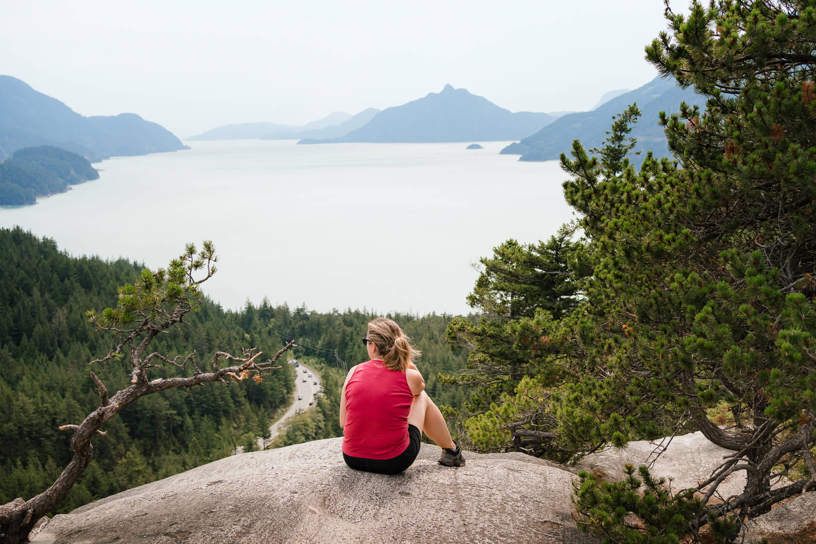
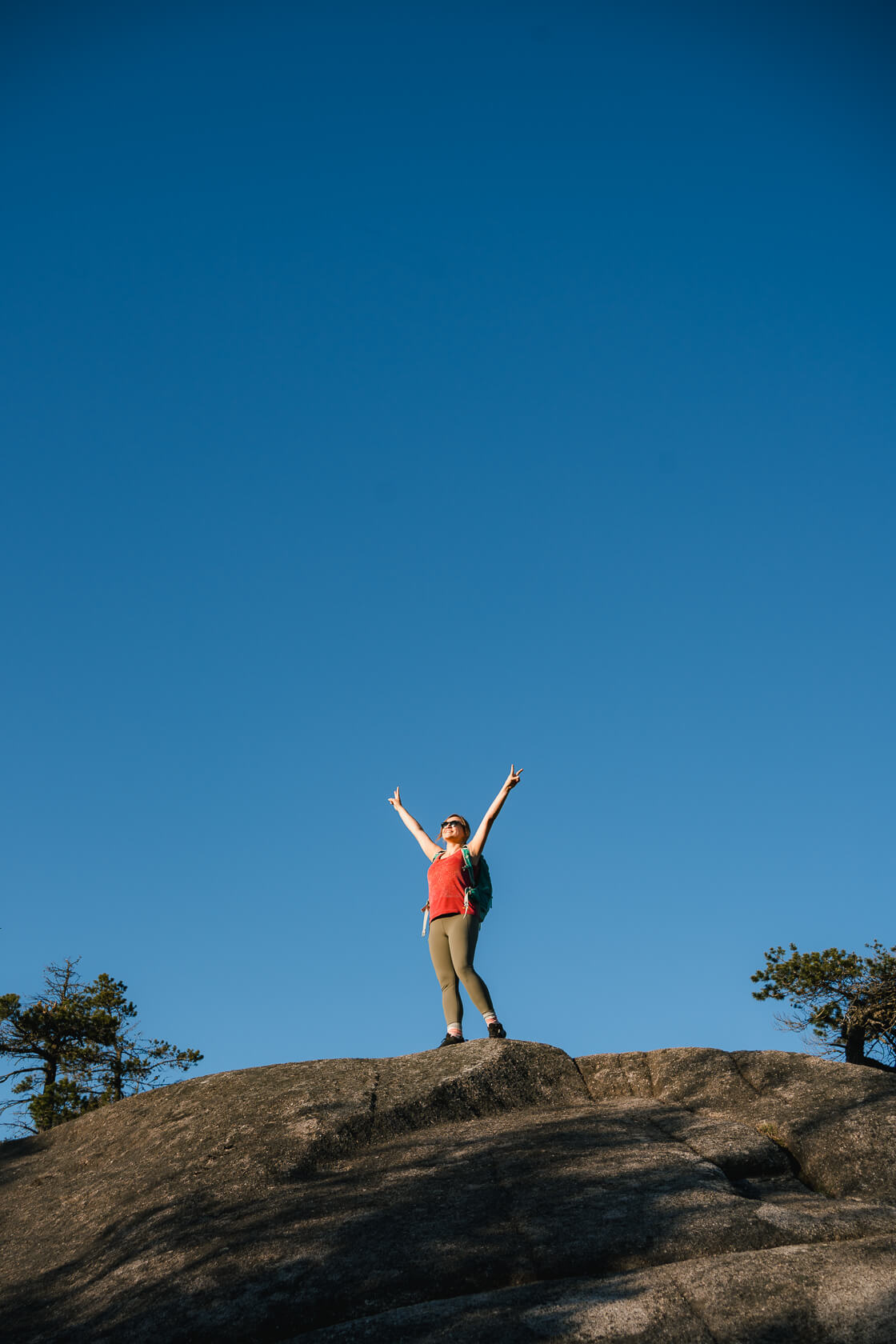
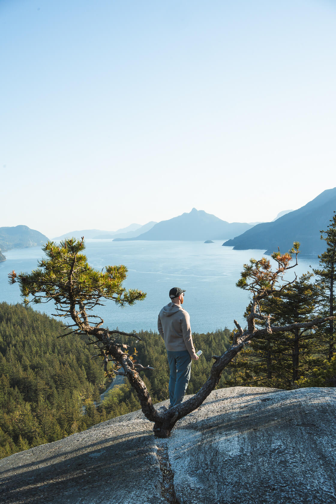
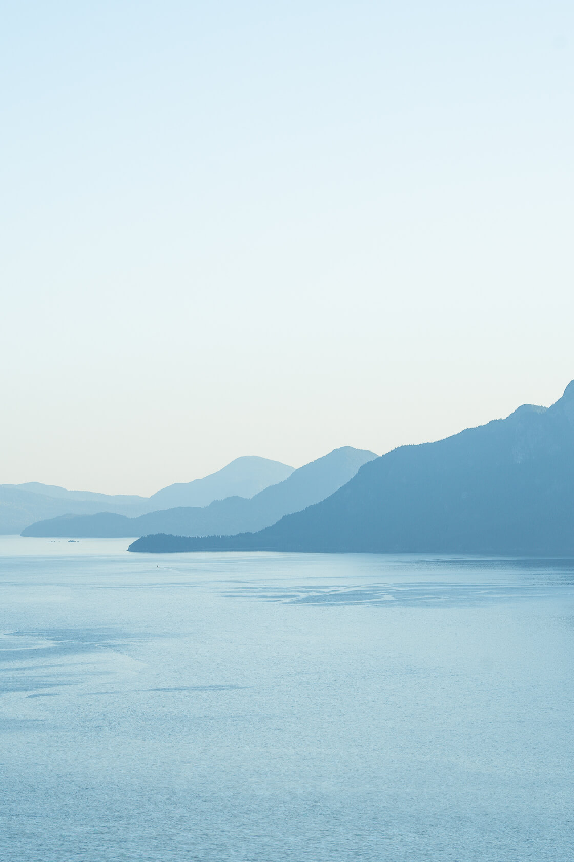
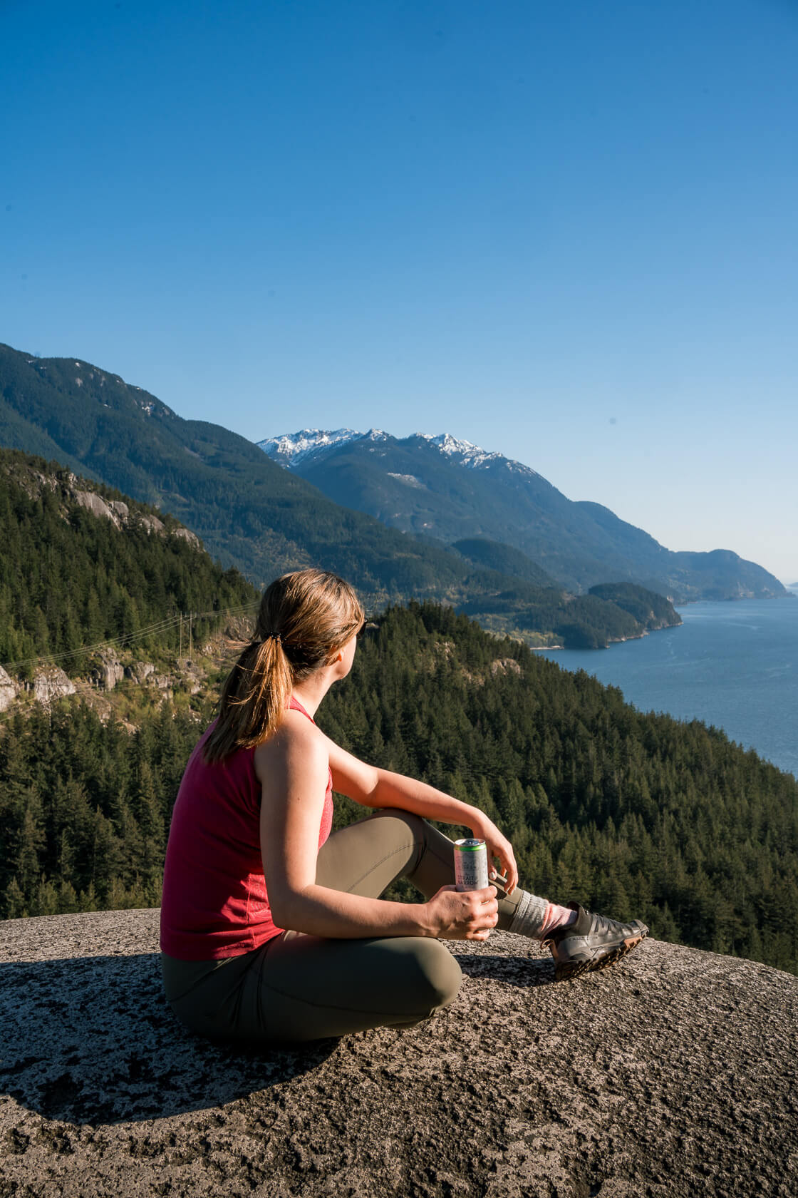
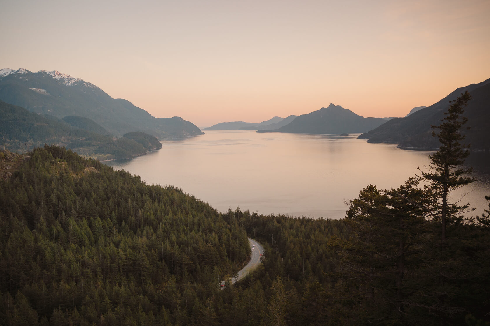
When we first hiked to Quercus Lookout, we had no idea it would become one of our favourite after-work hikes near Vancouver. The trail is a little steep but relatively short and the reward to effort ratio is fantastic. Within 30 minutes you can stand on a rocky viewpoint overlooking Howe Sound, Stawamus Chief and other mountains. If you’re looking for a bit more challenge, you can hike the entire Jurassic Ridge trail and make Quercus Lookout your last stop.
Planning considerations for the hike to Quercus Lookout:
Round trip distance: 1.4 km
Elevation gain/loss: 112 m
Peak elevation: 250 m
Best time to hike: All year round
Moving time: Around 30 minutes moderate pace (one way)
Permits: None
Dogs: Not recommended but allowed, so long as they’re on a leash
Mountain bikes: No
Pit toilets: By the parking lot (none along the trail)
Difficulty level: Easy (but steep)
Getting There
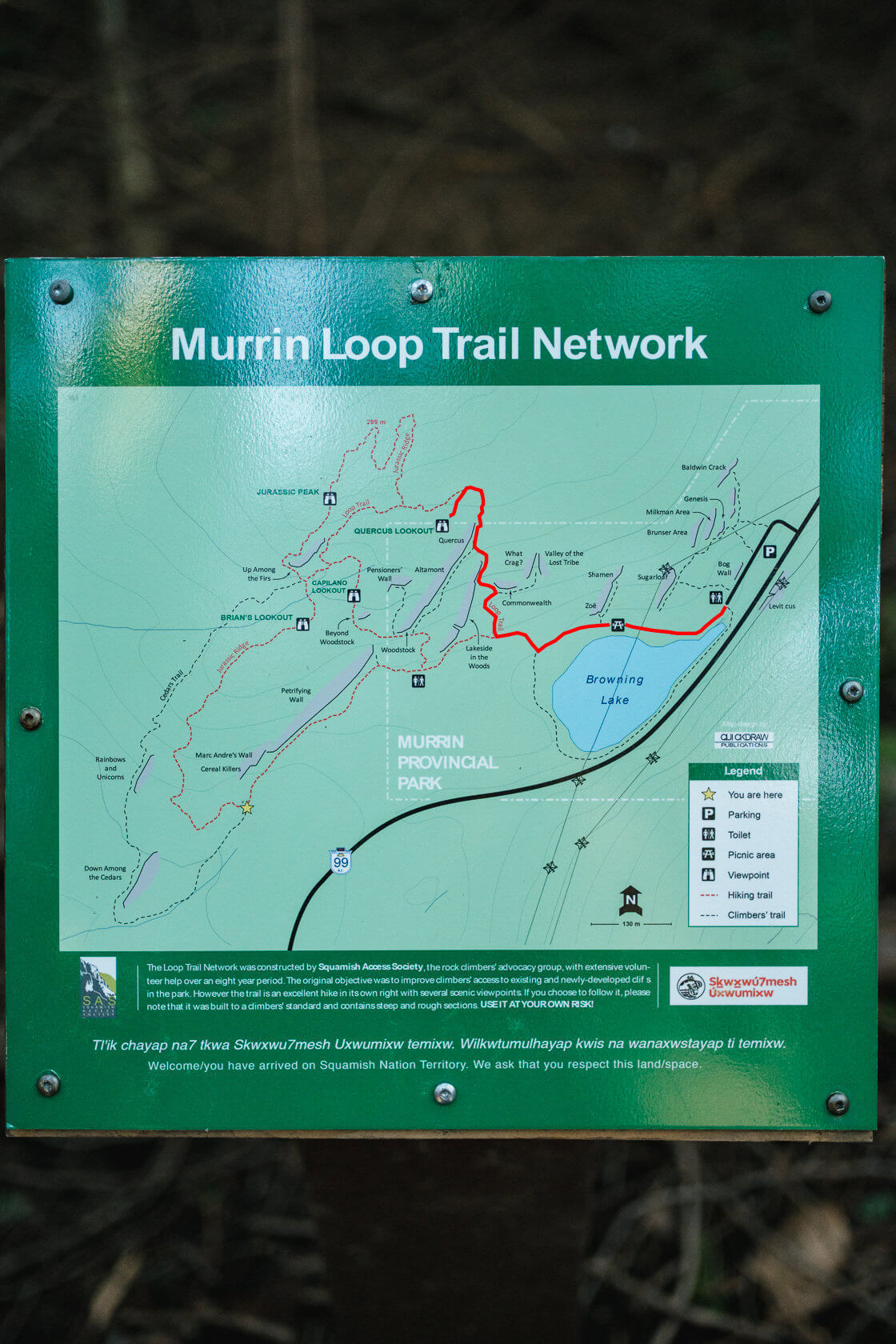
Quercus Lookout, also known as Quercus Point, is located in Murrin Provincial Park. The parking lot is right by the Sea to Sky highway, around 45 minutes from Vancouver. On summer weekends the parking lot fills up quickly with families, hikers, and climbers. Some come to relax by Browning Lake while others go hiking, bouldering or rock climbing. In short – there’s a lot to do in this relatively small area so the parking lot and the trails can get pretty busy!
How hard is the hike to Quercus Lookout?
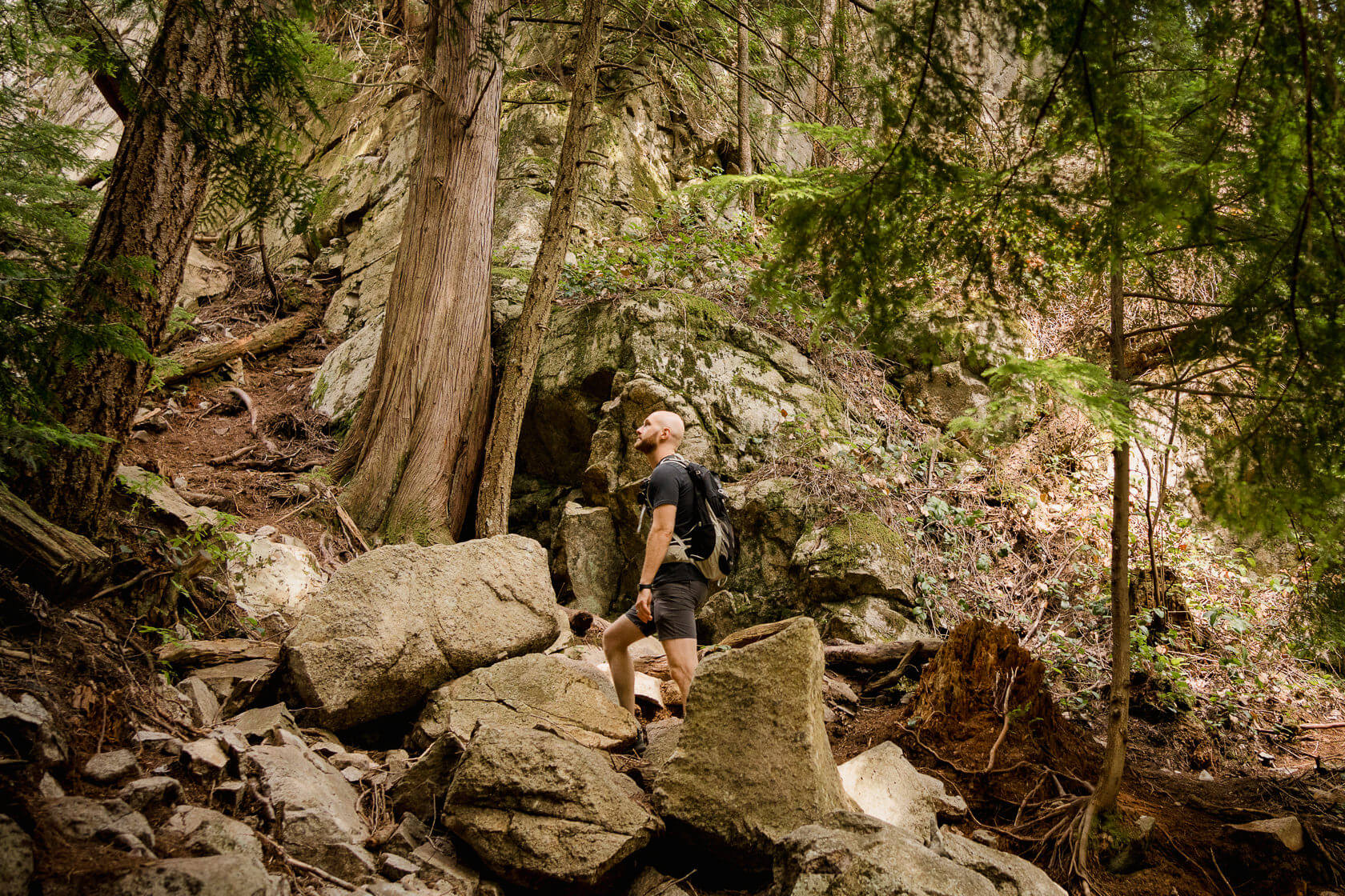
As frequent hikers, we consider the trail to Quercus Lookout easy as it’s relatively short and technically simple. But if you’re not used to hiking and don’t like sweating, you might find it more moderate than easy as it’s quite steep. Also, it was built with climbers rather than hikers in mind, so there are some rough sections with loose rocks and roots. But don’t let that discourage you as the view from the lookout is absolutely worth the effort!
Here are a few reasons why both hikers and non-hikers can enjoy this trail:
- The entire hike is in shade until you reach the lookout which is helpful on a hot day
- It’s a popular route so if you run into any trouble, you won’t be alone
- There’s cell service along the trail
- The route is well marked – just keep an eye on signs, especially near the top so you don’t accidentally continue along the Jurassic Ridge as that’s not an easy route
- The elevation gain is only 112 meters which is an equivalent of around 37 residential floors (112m / 3m). As far as hiking goes, this is nothing for the view that you get from the lookout!
The trail is likely to be snow free most of the year, but we wouldn’t recommend visiting when it’s icy, as the rocks at the viewpoint can become slippery and dangerous.
Quercus Lookout trail overview
After passing the day-use area by the lake, look to your right for a wooden marker pointing toward Quercus Lookout. Follow the path into the forest and climb over a small hill until you reach a fork in the trail. To stay on track and avoid veering onto the Jurrasic Ridge trail, take a right and begin climbing. This section involves a lot of stairs, both natural and man-made. You’ll have the forest on your right and rock formations on your left.
As you near the top of the rock, there will be another fork. Turn left and the trail will lead you directly to the viewpoint.
While the trail to Quercus Lookout is fairly well marked, it’s never a bad idea to download an offline map app like AllTrails. If you decide Quercus Lookout wasn’t challenging enough and you want to hike the entire Jurassic Ridge trail, having an offline map is a must. The Jurrasic Ridge trail is poorly marked and can be difficult to navigate in some places, especially since there are a lot of additional side trails for climbers that could lead you to a vertical rock face.
Where are the best views?
There’s really just one spot with a view here, and that’s the Quercus Lookout itself! 😊
Will I have Quercus Lookout to myself?
Probably not. It’s a short and popular hike with easy access, so it’s almost guaranteed there will be others around, especially on a nice weekend. The crowds do thin out in the evening though, so that might be a better time to visit.
Can I watch the sunset from Quercus Lookout?
The sun doesn’t set over the water yet many people still come here for sunset views. On a clear day, you can expect the viewpoint to be in the shade long before the official sunset time and the colour of the sky to change to pink/orange only above the horizon. However, if there are clouds in the sky (but not near the horizon), the setting sun can sometimes illuminate them in the most beautiful way. This is when the best sunsets happen at this lookout.
Items to bring with you to Quercus Lookout
The packing list for the hike to Quercus Lookout is pretty straightforward, but it’s always a good idea to come prepared:
- It may be helpful to have an offline map app like AllTrails, especially if you decide to carry on past Quercus Lookout.
- Wear comfortable hiking shoes or trail runners with good traction as you’ll have to tackle some natural stairs and walk over roots and rocks.
- As Squamish is home to black bears and other wildlife, it’s a good idea to carry bear spray and know the basics of bear behaviour, so that you can respond appropriately if you find yourself in an encounter.
- As it’s a steep trail, bring a bottle of water and some snacks. Personally, we love spending a little time at the lookout, having snacks and admiring the views.
- If you’re planning to do this hike around sunset bring a head torch.
- The entire trail is through a forest, but the lookout is completely open so if you’re planning to spend some time there, bring sunscreen.
- If you have issues with your knees, you may want to skip this one as the descent can be quite hard on them – though hiking poles might help.
Got more questions about the hike to Quercus Lookout?
Just drop them in the comments, and we’ll be glad to help! We always respond!
Read about other hikes in British Columbia here.
