


The Goat Ridge trail is one of the most beautiful hikes in Chilliwack. It’s challenging, but also incredibly rewarding.
There are two other trails in the Vancouver area called Goat Ridge. One is in Squamish and the other one is a sub-peak of Goat Mountain at Grouse Mountain. It’s easy to mix them up with Goat Ridge in Chilliwack. To make it even more confusing, you may also hear people refer to this hike as Porcupine Ridge. However, for this guide, let’s stick to calling it Goat Ridge.
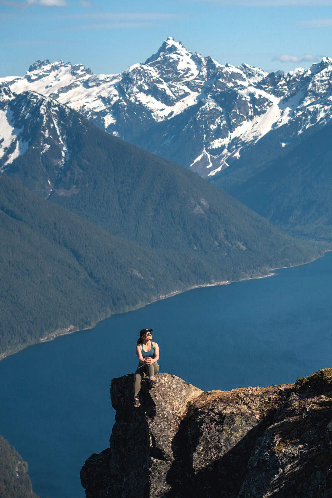
What can you expect on this hike? Stunning viewpoints of Chilliwack Lake, Lindeman Lake and the surrounding mountains. But be ready for a challenge – the trail is steep with loose dirt and rocks making it slippery and tiring. There are fixed ropes, small boulder fields and pretty much no flat sections. But if you’re an experienced hiker with good stamina, you’ll love it because the views are truly spectacular.
Planning Considerations
Distance: 13.7 km round trip
Difficulty: Moderately Hard
Elevation gain/loss: 1225m (elevation gain: 1020m)
Peak elevation: 1810m (but most people stop around 1600m)
Surface: Dirt and loose gravel for most of the trail, three boulder fields to cross
Best time to hike: late spring – early fall
Pure moving time: 7h (moderate pace)
Permits: n/a
Dogs: dogs are allowed on a leash, but the hike is extremely steep so we wouldn’t recommend it, even if you have a super high energy dog
Mountain bikes: No
Getting To The Goat Ridge Trailhead in Chilliwack
The trailhead is very close to the Lindeman Lake parking lot, around a 2-hour drive from downtown Vancouver. Once you park your car, walk back to the Chilliwack Lake Road, turn right, and walk about 200 meters. You will soon find the trailhead on your right. There’s no marker apart from one pink ribbon, but check AllTrails and you should be able to find it without any issues.
It’s useful to know that Lindeman Lake is a very popular destination, especially on hot summer weekends, so it’s a good idea to arrive early to secure a parking spot. You can park along the road, but this may add another kilometer or more to your hike depending on how busy it is. When we arrived on a sunny Sunday in May 2024 around 8:30 am, we didn’t have any trouble finding a space to park.
Good to know: this parking lot is known for break-ins, so don’t leave anything valuable in your car, and aim to get back before sunset.
Goat Ridge Trail Overview
When you see the ribbon at the trailhead, turn right and follow the trail into the forest. The path then veers left along a small creek. The first few hundred meters are flat. You will have to turn left and then right, but in both cases, going straight may seem like a more obvious choice, so keep an eye on the map.
After the second turn, you’ll have another few hundred meters of flat ground before the climb begins. Once the trail starts ascending, it will stay this way all the way to the top. There are no flat sections or downhill breaks, just a constant grind upwards.
Aside from the incline, there are two other challenges on this hike. The first is the type of surface you’ll be walking on which is loose dirt and gravel. It’s not too bad on the way up, but be careful on the descent as it’s easy to slip or trip. Hiking poles can be a big help!
The second challenge are rope sections. They’re fun, but there are at least five, and two of them are long and steep. The first rope section is quite close to the beginning of the trail and is one of the hardest. If you’re fine with this one, the rest should be okay too. Bear in mind that these ropes were put up by local hikers and are not maintained by BC Parks, so it’s up to you to make sure they’re safe to use.
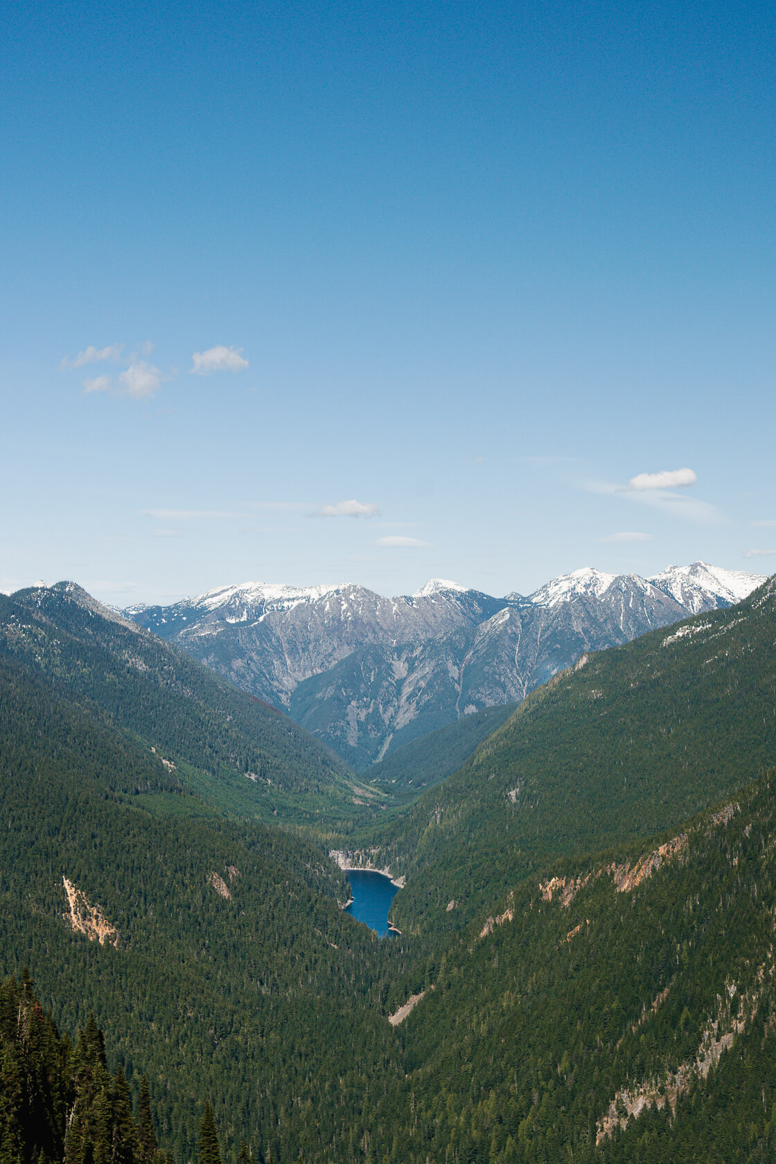
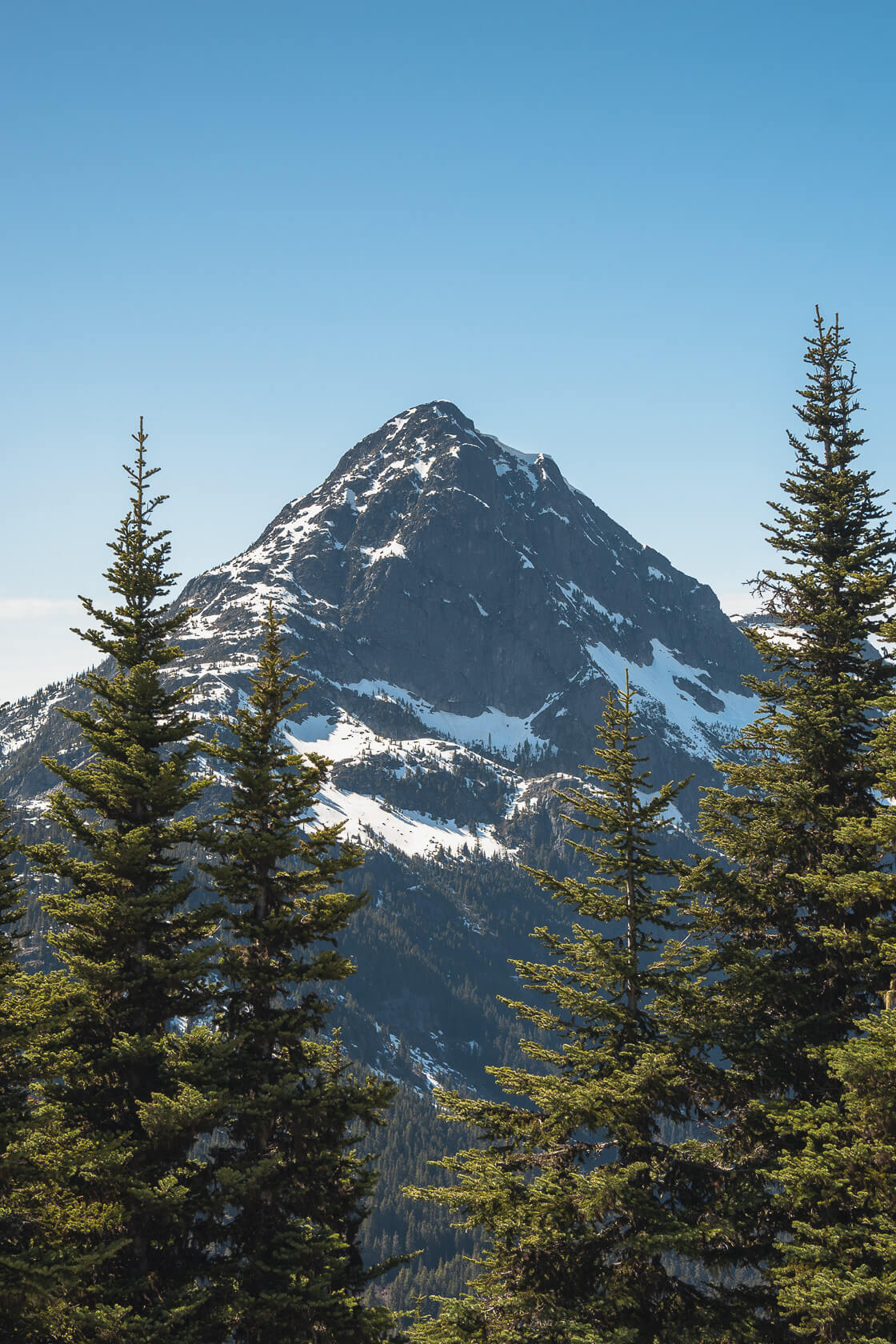
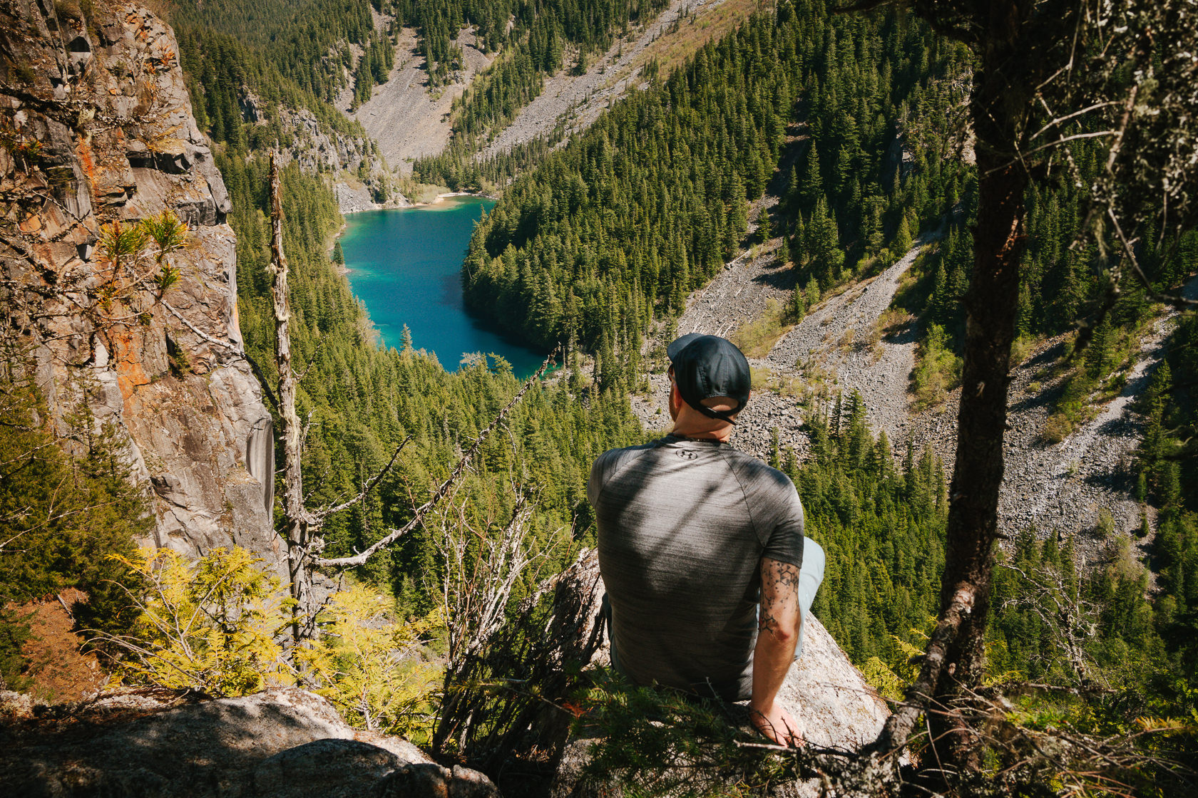
Although most of this hike is through a forest, from time to time you’ll catch glimpses of Chilliwack Lake and the surrounding mountains. After about 40% of the ascent, you’ll find the first viewpoint overlooking Lindeman Lake.
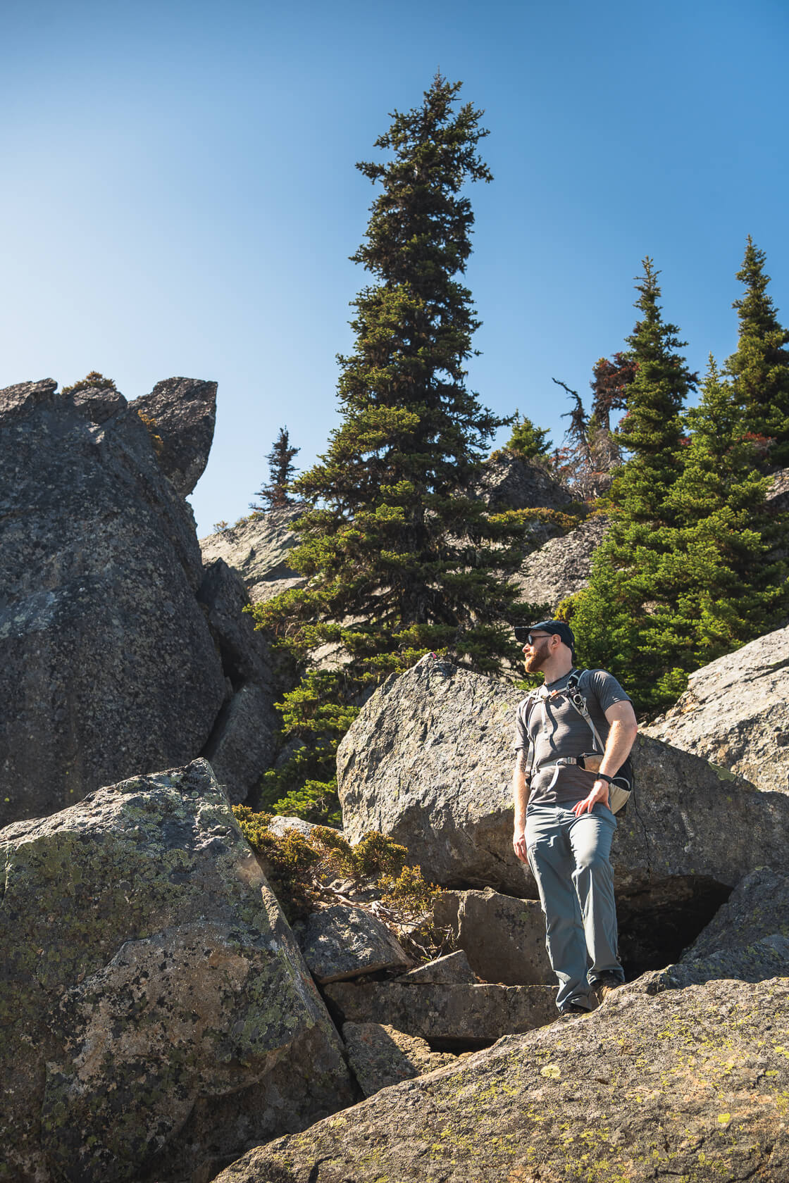
Towards the end, you’ll need to cross a couple of boulder fields, but they’re relatively easy unless there’s snow. We stopped at around 1600 meters at the famous viewpoint overlooking Chilliwack Lake. There was still quite a bit of snow beyond this point, so we decided not to push to the summit.
Where Are The Best Views On This Trail?
At around 1080 meters, you can take a short trail to the right for the first view of Lindeman Lake. It’s a good place to take a break, have some snacks, and take a breather.
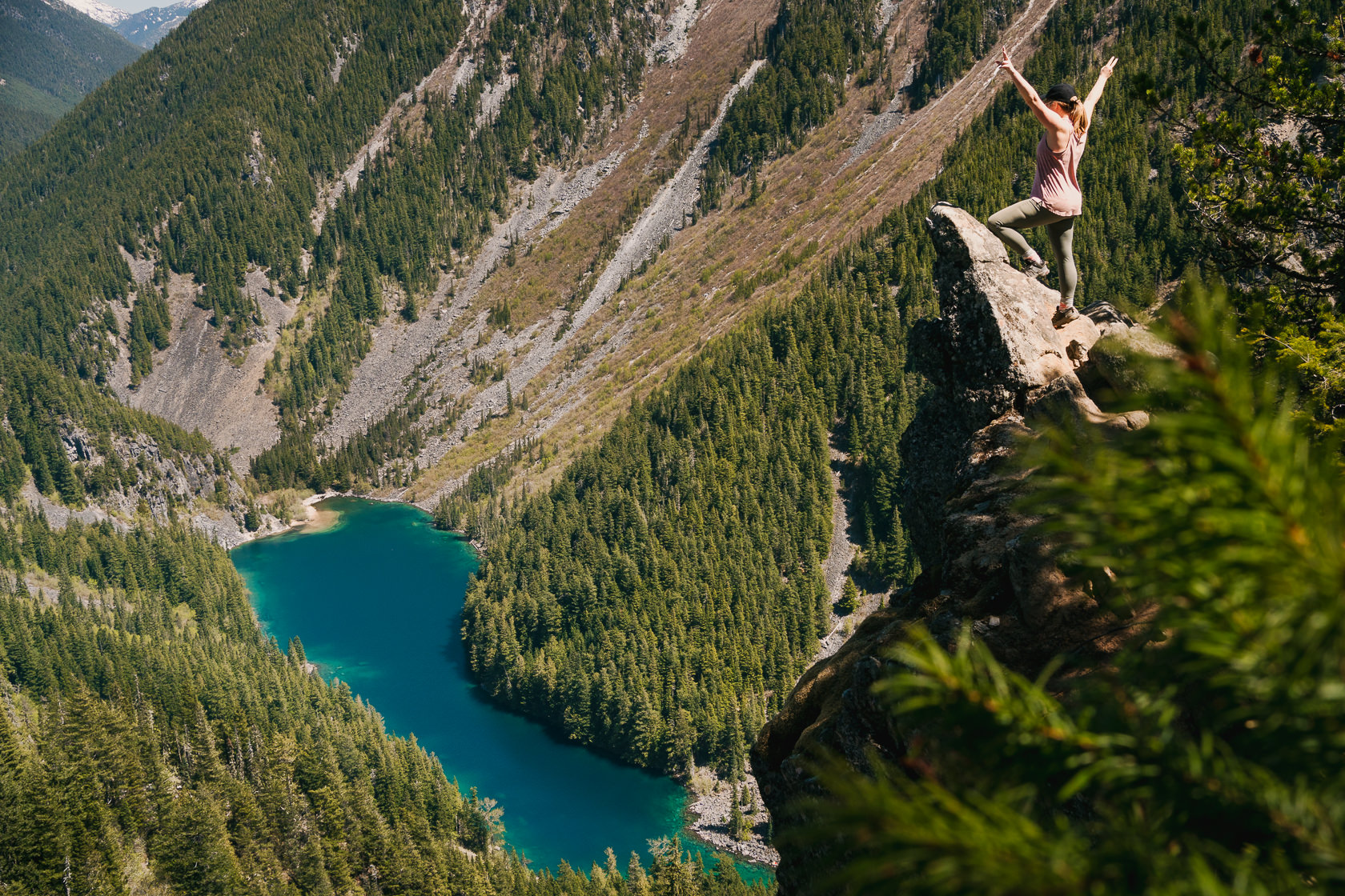
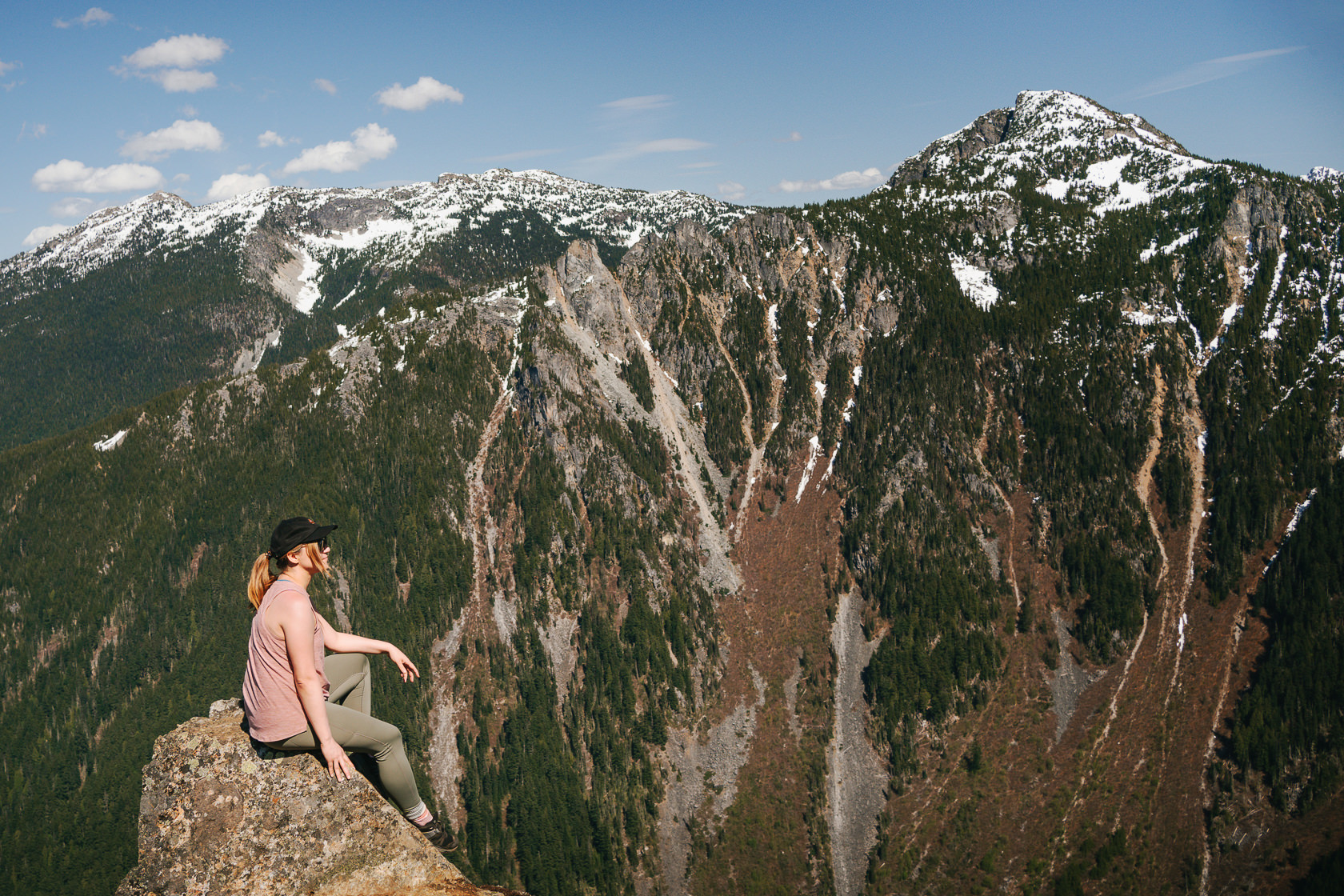
Not long after, you’ll be rewarded with another viewpoint overlooking Lindeman Lake, sometimes referred to as Porcupine Rock Viewpoint. This is where many hikers end their hike, as it’s still quite a trek from here to the ridge. If you’re bringing a camera, you’ll need a wide-angle lens to get a shot of yourself with Lindeman Lake in the background. The first photo in this article was taken with a 35mm lens, but we felt a 28mm lens would have been a better choice.
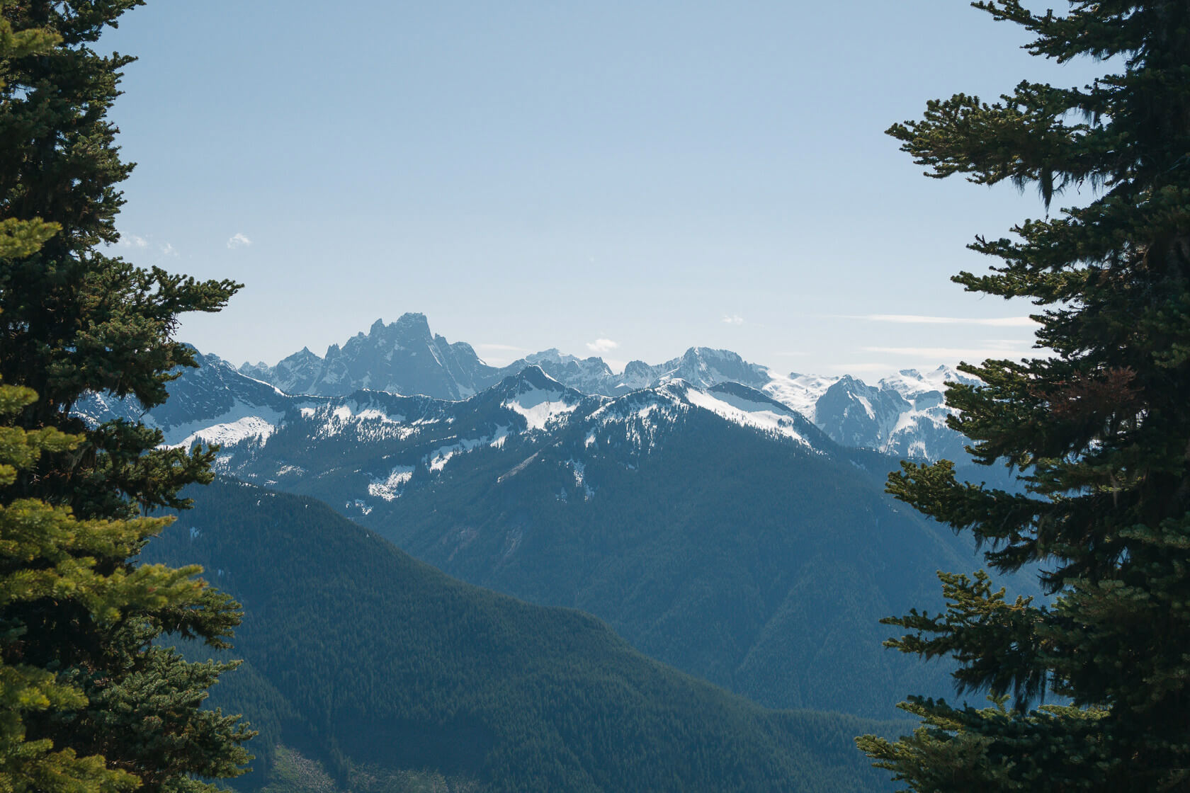
As you continue uphill, there are a few more viewpoints of Lindeman Lake, but now that you’ve decided to carry on, you probably already have your eyes on the prize, which is the ridge at 1600 meters. There, you can not only get the iconic shot with Chilliwack Lake and Mount Redoubt in the background, but you’ll also have great views of Greendrop Lake, Flora Peak, Williams Peak, Mount Slesse, and MacDonald Peak, to name just a few.
From the ridge, you can carry on to the actual peak at 1810 meters to enjoy 360-degree views of the surrounding area. We didn’t do that, as we were concerned about getting into bridged snow on the boulders, but there’s always next time!
Will I have the trail to myself?
Unlike many other hikes in this area, you don’t need a 4×4 to get to the trailhead so it should be quite a popular trail. However, the steepness and rope sections deter many hikers. When we did this hike on a beautiful weekend in mid-May, we saw less than 15 people on the trail. At one point, there were five others with us at the ridge, but for most of the time, we had the place to ourselves.
Tips for hiking Goat Ridge Trail in Chilliwack
Difficulty
You probably already figured this out, but this is a tough hike and not one to embark on unprepared! We felt it in our thighs for the next three days. It’s steep, the surface is loose, and there are long rope sections. Be prepared for an effort similar to Stawamus Chief, but over a longer distance and without any stairs. To put it in perspective, you’ll be tackling over 1000 meters of elevation gain and a 14-kilometer round trip from the parking lot. For comparison, the Chief involves about 750 meters of elevation and a 6-kilometer round trip.
Although there are ropes and a couple of boulder fields to cross, there’s never any real exposure or complex scrambling. It’s more challenging than a regular hike but not overly technical.
Length
Depending on how fit you are, this hike can take between 5 and 8 hours, not including any breaks. Because it’s steep, your pace may be slower than usual.
That said, it’s an out-and-back trail, so you can decide how far you want to go. Some hikers stop at the viewpoint overlooking Lindeman Lake, while others continue to the ridge with views of Chilliwack Lake and the surrounding mountains. It’s still quite a long way from here to the actual peak, so if you don’t want to go any further or are running out of time, the ridge is a good point to turn back.
Best time to hike Goat Ridge
Depending on the winter snowfall amounts, Goat Ridge Trail is best hiked from late spring to early fall. When we visited in May, the final part of the trail was still covered in snow, so we stopped on the ridge overlooking the Chilliwack Lake and didn’t continue to the peak.
As for the weather, it’s best to choose a clear day for this hike to enjoy the views. If it rains, the trail will be muddy and slippery, and the steep descent will be neither fun nor safe. You can check the latest trail conditions on AllTrails.
Goat Ridge Trail map
Don’t forget to download an offline map before your hike as there’s no cell reception on the trail. If you have the AllTrails app and GPS on your phone, you can track your progress and location on the app. You can sign up for AllTrails here.
Gear and what to bring
Wear hiking shoes or boots with good grip and ideally with ankle support. Hiking poles will be very helpful on the way down to reduce stress on your knees. You might also consider bringing gloves to protect your hands on the rope sections.
Make sure to bring at least 2-3 liters of water per person, as there is no water source anywhere on the trail. We had 2.5 liters per person on a sunny day and wished we had brought more.
As with any trip into the backcountry, bring layers and be well-prepared for changes in the weather.
Bears are often seen in the area, so bring bear spray and know how to use it.
Safety
You should have no problems doing this hike if you’re fit, well prepared and have the right gear.
The trail condition is good, but it’s not maintained by BC Parks, so hiking is at your own risk. You can expect wind-felled trees, ropes installed by other hikers, and absolutely no cell reception from the moment you step on the trail. Make sure you tell someone that you’re going and bring an offline map so you don’t get lost.

Unwritten rules
Since this is not an official BC Parks trail, it’s even more important to respect your surroundings and encourage others to do the same. We found a banana peel, tissues, and ashes from a campfire despite the warning sign at the trailhead prohibiting fires. This is selfish behaviour by hikers who have no respect for nature and other people on the trail. Don’t be that person.
– Stick to the trail to avoid damaging vegetation.
– Bring an extra bag to carry your trash and sort it out when you return.
– Don’t smoke, build fires, or use a lighter at any point on this hike.
Facilities
There is one outhouse in the Lindeman Lake car park, but none along the trail.
Got more questions about the hike?
Just drop them in the comments, and we’ll be glad to help!
Read about other hikes in British Columbia here.
